IMAGES TAKEN NEAR TO
Hitchin Road, HITCHIN, SG5 4JE
Introduction
This page details the photographs taken nearby to Hitchin Road, SG5 4JE by members of the Geograph project.
The Geograph project started in 2005 with the aim of publishing, organising and preserving representative images for every square kilometre of Great Britain, Ireland and the Isle of Man.

There are currently over 7.5m images from over14,400 individuals and you can help contribute to the project by visiting https://www.geograph.org.uk
Image Map (Loading...)


Getting Data...Please wait
Leaflet Map data © OpenStreetMap
Images are licensed for reuse under creativecommons.org/licenses/by-sa/2.0
Notes
- Clicking on the map will re-center to the selected point.
- The higher the marker number, the further away the image location is from the centre of the postcode.
Image Listing (19 Images Found)
Images are licensed for reuse under creativecommons.org/licenses/by-sa/2.0
Image
Details
Distance
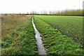
1
Hitchin Road, Stotfold
The outskirts of Stotfold.
Image: © Jeff Tomlinson
Taken: 31 Mar 2007
0.04 miles
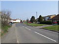
3
Hitchin Road at the corner of Pix Road
Image: © David Howard
Taken: 12 May 2018
0.07 miles
4
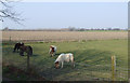
Miniature horses at Stotfold.
These very small and friendly miniature horses were in a field next to the bridleway.
Image: © Jeff Tomlinson
Taken: 31 Mar 2007
0.10 miles
6
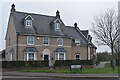
Modern house on the edge of Stotfold
Close to the A507, this house could currently claim to be on the very edge of Stotfold, although development continues in multiple locations nearby.
Image: © David Martin
Taken: 13 Nov 2022
0.12 miles
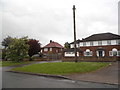
7

Herbal estate in Stotfold
The two main roads on this new housing estate are Valerian Way and Comfrey Road, but no Parsley or Dill if anyone remembers those on TV. It may well be what was grown there before the houses arrived.
Image: © David Howard
Taken: 12 May 2018
0.12 miles
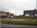
8
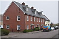
Apartment building on Valerian Way
The red brick building contains five flats, all entered through the central doorway. The outer doors and porches are fakes, added to enhance the street scene.
Image: © David Martin
Taken: 13 Nov 2022
0.15 miles
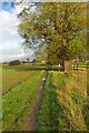
9
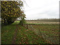
Footpath from Stotfold
To Church End and Arlesey. The path crosses the A507 Stotfold bypass about 500 metres ahead.
Image: © David Purchase
Taken: 13 Nov 2014
0.16 miles