IMAGES TAKEN NEAR TO
Bury End, HITCHIN, SG5 3QB
Introduction
This page details the photographs taken nearby to Bury End, SG5 3QB by members of the Geograph project.
The Geograph project started in 2005 with the aim of publishing, organising and preserving representative images for every square kilometre of Great Britain, Ireland and the Isle of Man.

There are currently over 7.5m images from over14,400 individuals and you can help contribute to the project by visiting https://www.geograph.org.uk
Image Map
Images are licensed for reuse under creativecommons.org/licenses/by-sa/2.0
Notes
- Clicking on the map will re-center to the selected point.
- The higher the marker number, the further away the image location is from the centre of the postcode.
Image Listing (41 Images Found)
Images are licensed for reuse under creativecommons.org/licenses/by-sa/2.0
Image
Details
Distance
1
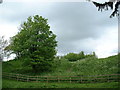
Toot Hill, Pirton
Motte and bailey, a former Norman castle site.
Image: © Sheila Russell
Taken: 6 May 2004
0.07 miles
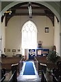
3
Church of St. Mary, Pirton
Built in the early 12C, originally with transepts but they were destroyed when the tower collapsed in the 13C. The tower was rebuilt in 1876-7 and the south transept (with the red-tiled roof) as a vestry in 1907-14. The porch had two storeys, but the floor has been removed.
Image: © Humphrey Bolton
Taken: Unknown
0.08 miles
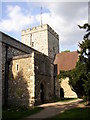
4
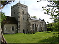
Church of St. Mary, Pirton, north side
The tower was rebuilt in 1876-7 but looks convincingly medieval. The chancel was restored in 1948 and given a red-tiled roof like the south transept. Halfway along the nave is the 14C north door, however the doorway is blocked inside.
Image: © Humphrey Bolton
Taken: Unknown
0.08 miles
5
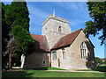
St Mary's Pirton
The original church was built in C12 and had a central tower, chancel and nave. Alterations were made in C14 and C15 and during the restoration of 1883, the tower was rebuilt.
Image: © Bikeboy
Taken: 15 Aug 2015
0.10 miles
6
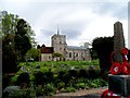
St Mary, Pirton
The original church was built in C12 and had a central tower, chancel and nave. Alterations were made in C14 and C15 and during the restoration of 1883, the tower was rebuilt.
Image: © Bikeboy
Taken: 12 May 2013
0.10 miles
7
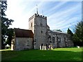
St Mary's, Pirton
The original church was built in C12 and had a central tower, chancel and nave. Alterations were made in C14 and C15 and during the restoration of 1883, the tower was rebuilt.
Image: © Bikeboy
Taken: 15 Aug 2015
0.10 miles
8
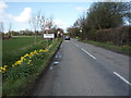
Entering Pirton
Heading north west on Hitchin Road.
Image: © JThomas
Taken: 25 Mar 2016
0.11 miles
9

Farmland, Pirton
A footpath follows this hedgerow between arable fields, heading towards the village where the church tower can be seen.
Image: © Andrew Smith
Taken: 10 Oct 2010
0.11 miles