
IMAGES TAKEN NEAR TO
Church View Avenue, HITCHIN, SG5 3NL
Introduction
This page details the photographs taken nearby to Church View Avenue, SG5 3NL by members of the Geograph project.
The Geograph project started in 2005 with the aim of publishing, organising and preserving representative images for every square kilometre of Great Britain, Ireland and the Isle of Man.

There are currently over 7.5m images from over14,400 individuals and you can help contribute to the project by visiting https://www.geograph.org.uk
Image Map
Images are licensed for reuse under creativecommons.org/licenses/by-sa/2.0
Notes
- Clicking on the map will re-center to the selected point.
- The higher the marker number, the further away the image location is from the centre of the postcode.
Image Listing (53 Images Found)
Images are licensed for reuse under creativecommons.org/licenses/by-sa/2.0
Image
Details
Distance
1
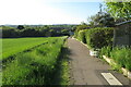
John Bunyan Trail going down to Hillfoot End
Image: © Philip Jeffrey
Taken: 30 May 2021
0.04 miles
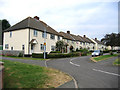
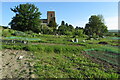
4

Shillington from the air
All Saints Church and allotments in the lower part of the picture, and the houses are on Hillside Road and Close, Hillfoot Road and Church View Avenue.
Image: © M J Richardson
Taken: 28 Jun 2012
0.11 miles
5
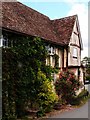
Timber-framed house, Church Street, Shillington
Image: © Jim Osley
Taken: 25 Jul 2015
0.12 miles
6
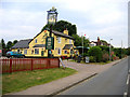
Noah's Ark, Shillington, Beds
on Hillfoot Road, Hillfoot End.
Image: © Rodney Burton
Taken: 27 Jun 2006
0.12 miles


10
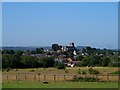
Shillington from Clawders Hill Farm
The church of All Saints can be clearly seen to occupy the highest ground in the village. Most of the church is C14 except for the brick tower which was added in C18.
Image: © Bikeboy
Taken: 15 Aug 2015
0.13 miles