Shillington from the air
Introduction
The photograph on this page of Shillington from the air by M J Richardson as part of the Geograph project.
The Geograph project started in 2005 with the aim of publishing, organising and preserving representative images for every square kilometre of Great Britain, Ireland and the Isle of Man.

There are currently over 7.5m images from over 14,400 individuals and you can help contribute to the project by visiting https://www.geograph.org.uk
Shillington from the air
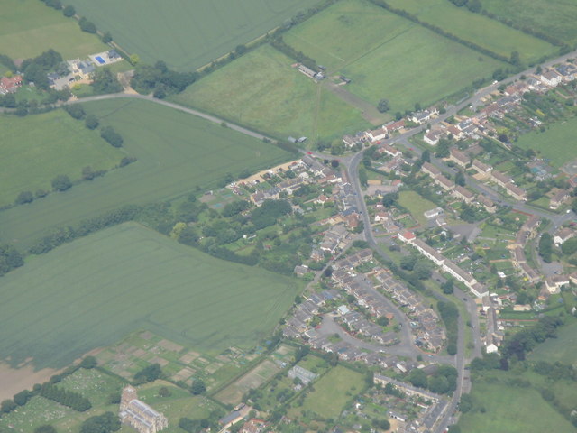
Image: © M J Richardson Taken: 28 Jun 2012
All Saints Church and allotments in the lower part of the picture, and the houses are on Hillside Road and Close, Hillfoot Road and Church View Avenue.
Images are licensed for reuse under creativecommons.org/licenses/by-sa/2.0
Image Location
Latitude
51.995189
Longitude
-0.36707