IMAGES TAKEN NEAR TO
Hitchin Road, HITCHIN, SG4 8WT
Introduction
This page details the photographs taken nearby to Hitchin Road, SG4 8WT by members of the Geograph project.
The Geograph project started in 2005 with the aim of publishing, organising and preserving representative images for every square kilometre of Great Britain, Ireland and the Isle of Man.

There are currently over 7.5m images from over14,400 individuals and you can help contribute to the project by visiting https://www.geograph.org.uk
Image Map
Images are licensed for reuse under creativecommons.org/licenses/by-sa/2.0
Notes
- Clicking on the map will re-center to the selected point.
- The higher the marker number, the further away the image location is from the centre of the postcode.
Image Listing (13 Images Found)
Images are licensed for reuse under creativecommons.org/licenses/by-sa/2.0
Image
Details
Distance
3
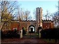
Tower Lodge Knebworth House (2)
See http://www.geograph.org.uk/photo/3787182 for more information
Image: © Bikeboy
Taken: 22 Dec 2013
0.07 miles
4
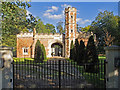
Tower lodges, Knebworth
Pair of linked lodges - Grade II listed. Description at this https://historicengland.org.uk/listing/the-list/list-entry/1102809.
Image: © Jim Osley
Taken: 5 Oct 2016
0.07 miles
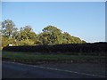
5
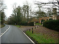
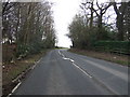
Junction of Three Houses Lane with the B656
Image: © JThomas
Taken: 22 Feb 2014
0.08 miles
6
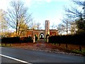
Tower Lodge, Knebworth House
The stone above the arch reads "THIS LODGE WAS BUILT TO COMMEMORATE THE ANCIENT GATEWAY OR LODGE WHICH STOOD IN FRONT OF KNEBWORTH HOUSE BEFORE IT WAS ALTERED OF WHICH THIS IS THE REPRESENTATION THE STONES OF THE ARCHWAY HAVING BEEN NUMBERED THAT THEY MIGHT BE REPLACED AS BEFORE" (no punctuation!).
The tower has a Tudor look about it. The archway is glazed now and the church at Knebworth is framed by it.
It was built in 1816 from Tudor brick salvage from the gate house to Knebworth House which was demolished in 1811. See https://historicengland.org.uk/listing/the-list/list-entry/1102809 for entry in Listed Buildings
See http://www.geograph.org.uk/photo/3787186 for a closer look.
Image: © Bikeboy
Taken: 22 Dec 2013
0.08 miles
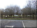
9
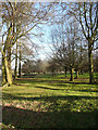
Wood pasture near Tower Lodges, Codicote
The trees are fare enough apart to allow grass to grow.
Image: © Humphrey Bolton
Taken: 15 Jan 2020
0.13 miles
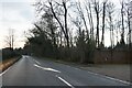
10
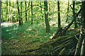
Bluebells in "Winter Wood"
This photograph was taken during a cycle ride. Bluebells have become quite a rarity these days.
Image: © Richard Reeve
Taken: 15 May 2005
0.19 miles