IMAGES TAKEN NEAR TO
Langley End, HITCHIN, SG4 7PT
Introduction
This page details the photographs taken nearby to Langley End, SG4 7PT by members of the Geograph project.
The Geograph project started in 2005 with the aim of publishing, organising and preserving representative images for every square kilometre of Great Britain, Ireland and the Isle of Man.

There are currently over 7.5m images from over14,400 individuals and you can help contribute to the project by visiting https://www.geograph.org.uk
Image Map (Loading...)


Getting Data...Please wait
Leaflet Map data © OpenStreetMap
Images are licensed for reuse under creativecommons.org/licenses/by-sa/2.0
Notes
- Clicking on the map will re-center to the selected point.
- The higher the marker number, the further away the image location is from the centre of the postcode.
Image Listing (6 Images Found)
Images are licensed for reuse under creativecommons.org/licenses/by-sa/2.0
Image
Details
Distance
1
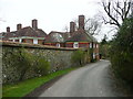
Hill End Farm Lane and Bathgate House, Langley
Image: © Humphrey Bolton
Taken: 17 Feb 2016
0.04 miles
2
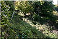
Sign to Hill End Chalk Pit, Langley (Herts)
The former chalk pit is now a nature reserve. The site once had SSSI status on account of the fossiliferous content of the Chalk but is now overgrown.
Image: © David Kemp
Taken: 15 Oct 2022
0.07 miles
3
Hill End Chalk Pit, Langley (Herts)
The former chalk pit is now a nature reserve. The site once had SSSI status on account of the fossiliferous content of the Chalk but is now overgrown.
Image: © David Kemp
Taken: 15 Oct 2022
0.08 miles
4
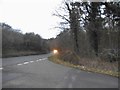
Hitchwood Lane at the junction of the B651
Image: © David Howard
Taken: 24 Dec 2017
0.13 miles