IMAGES TAKEN NEAR TO
Bragbury Lane, KNEBWORTH, SG3 6QZ
Introduction
This page details the photographs taken nearby to Bragbury Lane, SG3 6QZ by members of the Geograph project.
The Geograph project started in 2005 with the aim of publishing, organising and preserving representative images for every square kilometre of Great Britain, Ireland and the Isle of Man.

There are currently over 7.5m images from over14,400 individuals and you can help contribute to the project by visiting https://www.geograph.org.uk
Image Map
Images are licensed for reuse under creativecommons.org/licenses/by-sa/2.0
Notes
- Clicking on the map will re-center to the selected point.
- The higher the marker number, the further away the image location is from the centre of the postcode.
Image Listing (5 Images Found)
Images are licensed for reuse under creativecommons.org/licenses/by-sa/2.0
Image
Details
Distance
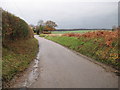
2
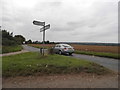
Bury Lane at the junction of Baines Lane
Image: © David Howard
Taken: 7 Sep 2017
0.14 miles
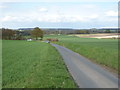
4
Datchworth: Baines Lane
As an illustration of how descriptive words can change all the Ordnance Survey maps from 1884 to 1946 have this as Baines's Lane.
Image: © Nigel Cox
Taken: 29 Nov 2009
0.22 miles