IMAGES TAKEN NEAR TO
Breakspear, STEVENAGE, SG2 9SQ
Introduction
This page details the photographs taken nearby to Breakspear, SG2 9SQ by members of the Geograph project.
The Geograph project started in 2005 with the aim of publishing, organising and preserving representative images for every square kilometre of Great Britain, Ireland and the Isle of Man.

There are currently over 7.5m images from over14,400 individuals and you can help contribute to the project by visiting https://www.geograph.org.uk
Image Map
Images are licensed for reuse under creativecommons.org/licenses/by-sa/2.0
Notes
- Clicking on the map will re-center to the selected point.
- The higher the marker number, the further away the image location is from the centre of the postcode.
Image Listing (11 Images Found)
Images are licensed for reuse under creativecommons.org/licenses/by-sa/2.0
Image
Details
Distance
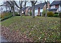
1
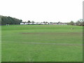
Football pitches
These are to the north west of the running track.
Image: © Robin Hall
Taken: 29 Nov 2005
0.19 miles
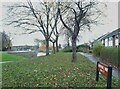
2
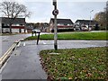
Taywood Close at the junction of Shephall Way
Image: © David Howard
Taken: 14 Nov 2021
0.20 miles
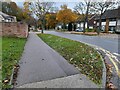
4
Shephall Way at the junction of Taywood Close
Image: © David Howard
Taken: 14 Nov 2021
0.21 miles
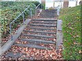
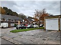
9
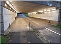
Subway in Stevenage
These carry the cycle paths under the roundabouts
Image: © David Howard
Taken: 14 Nov 2021
0.24 miles
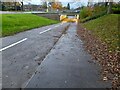
10
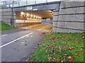
Cycle path in Stevenage
This goes underneath the roundabout and has branches leading off in all the directions.
Image: © David Howard
Taken: 14 Nov 2021
0.25 miles