IMAGES TAKEN NEAR TO
Fieldfare, STEVENAGE, SG2 9NJ
Introduction
This page details the photographs taken nearby to Fieldfare, SG2 9NJ by members of the Geograph project.
The Geograph project started in 2005 with the aim of publishing, organising and preserving representative images for every square kilometre of Great Britain, Ireland and the Isle of Man.

There are currently over 7.5m images from over14,400 individuals and you can help contribute to the project by visiting https://www.geograph.org.uk
Image Map
Images are licensed for reuse under creativecommons.org/licenses/by-sa/2.0
Notes
- Clicking on the map will re-center to the selected point.
- The higher the marker number, the further away the image location is from the centre of the postcode.
Image Listing (17 Images Found)
Images are licensed for reuse under creativecommons.org/licenses/by-sa/2.0
Image
Details
Distance
2
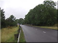
Footpath and cycle path, Stevenage
A footpath and cycle path in Stevenage in Hertfordshire.
Image: © Malc McDonald
Taken: 25 Sep 2022
0.10 miles
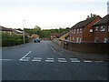
3
Magpie Crescent, Stevenage
Looking towards junction with Gresley Way.
Image: © JThomas
Taken: 27 Jul 2019
0.12 miles
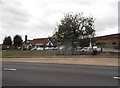
4
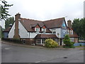
The Coopers Inn, Stevenage
On Magpie Crescent.
Image: © JThomas
Taken: 27 Jul 2019
0.12 miles
5
Lapwing Rise, Stevenage
Lapwing Rise is a residential cul-de-sac in Stevenage.
Image: © Malc McDonald
Taken: 25 Sep 2022
0.12 miles
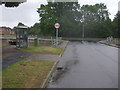
6
Gresley Way, Stevenage
Looking towards Coopers Inn
Image: © David Howard
Taken: 7 Sep 2017
0.12 miles
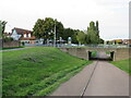
7
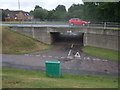
Underpass beneath Gresley Way, Stevenage
Used by a cycle path.
Image: © JThomas
Taken: 27 Jul 2019
0.12 miles
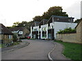
8
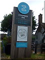
Sign for the Coopers Inn, Stevenage
See Image] for context.
Image: © JThomas
Taken: 27 Jul 2019
0.13 miles
10
Cotney Croft, Stevenage
Cotney Croft is a residential cul-de-sac in Stevenage.
Image: © Malc McDonald
Taken: 25 Sep 2022
0.14 miles