IMAGES TAKEN NEAR TO
Bragbury Lane, STEVENAGE, SG2 8TJ
Introduction
This page details the photographs taken nearby to Bragbury Lane, SG2 8TJ by members of the Geograph project.
The Geograph project started in 2005 with the aim of publishing, organising and preserving representative images for every square kilometre of Great Britain, Ireland and the Isle of Man.

There are currently over 7.5m images from over14,400 individuals and you can help contribute to the project by visiting https://www.geograph.org.uk
Image Map
Images are licensed for reuse under creativecommons.org/licenses/by-sa/2.0
Notes
- Clicking on the map will re-center to the selected point.
- The higher the marker number, the further away the image location is from the centre of the postcode.
Image Listing (15 Images Found)
Images are licensed for reuse under creativecommons.org/licenses/by-sa/2.0
Image
Details
Distance
2
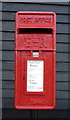
Elizabeth II postbox on Pembridge Gardens
Postbox No. SG2 100.
See Image] for context.
Image: © JThomas
Taken: 23 Apr 2016
0.05 miles
3
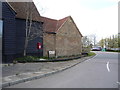
Pembridge Gardens
Showing position of Postbox No. SG2 100.
See Image] for postbox.
Image: © JThomas
Taken: 23 Apr 2016
0.05 miles
4
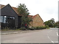
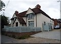
Pembridge Gardens, Bragbury End
It seems to be a barn conversion on the left. Compare with very similar photo a year earlier. http://www.geograph.org.uk/photo/4934044
Image: © David Howard
Taken: 7 Sep 2017
0.05 miles
7
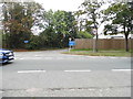
Broadhall Way at the junction of Bragbury Lane
Image: © David Howard
Taken: 7 Sep 2017
0.07 miles
9
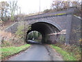
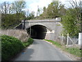
Bragbury End: Bragbury Lane railway bridge
This fine skewed bridge dates from the very end of the main railway building era and was built by the Great Northern Railway on their Enfield and Stevenage Loop Line. It is present on the Ordnance Survey map of 1923 but not on the edition of 1899, which gives some clue as to when the railway was built.
Image: © Nigel Cox
Taken: 29 Nov 2009
0.12 miles