IMAGES TAKEN NEAR TO
The Chace, STEVENAGE, SG2 8QS
Introduction
This page details the photographs taken nearby to The Chace, SG2 8QS by members of the Geograph project.
The Geograph project started in 2005 with the aim of publishing, organising and preserving representative images for every square kilometre of Great Britain, Ireland and the Isle of Man.

There are currently over 7.5m images from over14,400 individuals and you can help contribute to the project by visiting https://www.geograph.org.uk
Image Map
Images are licensed for reuse under creativecommons.org/licenses/by-sa/2.0
Notes
- Clicking on the map will re-center to the selected point.
- The higher the marker number, the further away the image location is from the centre of the postcode.
Image Listing (35 Images Found)
Images are licensed for reuse under creativecommons.org/licenses/by-sa/2.0
Image
Details
Distance
2
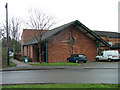
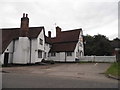
St Paul's Methodist Church..
Tucked away behind shops. The minister might say that the shops are tucked away behind the church.
Image: © Robin Hall
Taken: 17 Jan 2005
0.05 miles
5
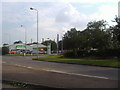
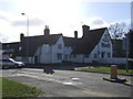
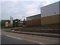
Business park entrance, London Road Stevenage
Image: © David Howard
Taken: 3 Aug 2011
0.08 miles
8
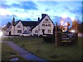
Entrance to the Toby Carvery, London Road
Image: © David Howard
Taken: 3 Aug 2011
0.09 miles