IMAGES TAKEN NEAR TO
The Heath, STEVENAGE, SG2 7PZ
Introduction
This page details the photographs taken nearby to The Heath, SG2 7PZ by members of the Geograph project.
The Geograph project started in 2005 with the aim of publishing, organising and preserving representative images for every square kilometre of Great Britain, Ireland and the Isle of Man.

There are currently over 7.5m images from over14,400 individuals and you can help contribute to the project by visiting https://www.geograph.org.uk
Image Map
Images are licensed for reuse under creativecommons.org/licenses/by-sa/2.0
Notes
- Clicking on the map will re-center to the selected point.
- The higher the marker number, the further away the image location is from the centre of the postcode.
Image Listing (14 Images Found)
Images are licensed for reuse under creativecommons.org/licenses/by-sa/2.0
Image
Details
Distance
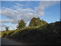
5
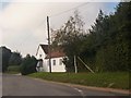
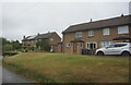
Former Chequers public house
On the B1037 at Ardeley Cromer.
Image: © David960
Taken: 1 Oct 2014
0.05 miles
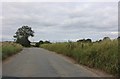
10
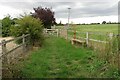
Footpath along the eastern edge of Cromer
Image: © Philip Jeffrey
Taken: 18 Sep 2022
0.20 miles