IMAGES TAKEN NEAR TO
Beecroft Lane, STEVENAGE, SG2 7PE
Introduction
This page details the photographs taken nearby to Beecroft Lane, SG2 7PE by members of the Geograph project.
The Geograph project started in 2005 with the aim of publishing, organising and preserving representative images for every square kilometre of Great Britain, Ireland and the Isle of Man.

There are currently over 7.5m images from over14,400 individuals and you can help contribute to the project by visiting https://www.geograph.org.uk
Image Map
Images are licensed for reuse under creativecommons.org/licenses/by-sa/2.0
Notes
- Clicking on the map will re-center to the selected point.
- The higher the marker number, the further away the image location is from the centre of the postcode.
Image Listing (41 Images Found)
Images are licensed for reuse under creativecommons.org/licenses/by-sa/2.0
Image
Details
Distance
1
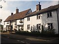
Houses on the A1037 at Walkern
Oakbeam (left) is Grade II* listed: http://www.britishlistedbuildings.co.uk/en-159687-oakbeam-walkern-hertfordshire
Image: © David960
Taken: 1 Oct 2014
0.02 miles
3
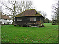
Granary, College Farm, Walkern
This is all that is left of the farm, which burnt down long ago. It is listed, Grade II, but has a hole in the roof and looks derelict. A small opening in the centre of the wall suggests that it might have been used to house hens.
Image: © Humphrey Bolton
Taken: 11 Jan 2020
0.04 miles
4
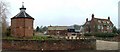
Manor Farm, Walkern.
Just over the wall is a large pond. The round building to the left seems to be used as accommodation.
Image: © Robin Hall
Taken: 7 Feb 2006
0.04 miles
5
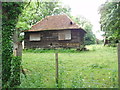
Broken down grain store, Walkern
The base of the building is raised above the ground. Built in C18. The only remaining building of College Farm which was destroyed in a fire in C20. See http://www.britishlistedbuildings.co.uk/en-159677-granary-at-the-old-rectory-140-metres-to for entry in British Listed Buildings.
Image: © Bikeboy
Taken: 17 Jun 2012
0.05 miles
6
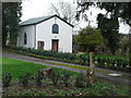
United Reformed Church, High Street, Walkern
Built in 1811 as a Congregational chapel, and listed, Grade II.
Image: © Humphrey Bolton
Taken: 11 Jan 2020
0.06 miles
7
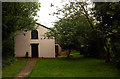
Walkern United Reformed Church (1811)
Grade II listed http://www.britishlistedbuildings.co.uk/en-159678-walkern-free-church-united-reformed-meth
Image: © Jim Osley
Taken: 8 Oct 2010
0.06 miles
8
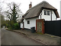
Wych Elm Cottage, Church End, Walkern
This is a very old cottage, 15C or early 16C, listed Grade II.
Image: © Humphrey Bolton
Taken: 11 Jan 2020
0.09 miles
9
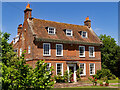
Walkern : Manor Farm farmhouse
Grade II* listed - description at this https://historicengland.org.uk/listing/the-list/list-entry/1348003.
Image: © Jim Osley
Taken: 14 Jun 2021
0.10 miles