IMAGES TAKEN NEAR TO
Benington Road, STEVENAGE, SG2 7HX
Introduction
This page details the photographs taken nearby to Benington Road, SG2 7HX by members of the Geograph project.
The Geograph project started in 2005 with the aim of publishing, organising and preserving representative images for every square kilometre of Great Britain, Ireland and the Isle of Man.

There are currently over 7.5m images from over14,400 individuals and you can help contribute to the project by visiting https://www.geograph.org.uk
Image Map
Images are licensed for reuse under creativecommons.org/licenses/by-sa/2.0
Notes
- Clicking on the map will re-center to the selected point.
- The higher the marker number, the further away the image location is from the centre of the postcode.
Image Listing (6 Images Found)
Images are licensed for reuse under creativecommons.org/licenses/by-sa/2.0
Image
Details
Distance
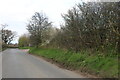
2

Byway Ford at Walkern
This is the third ford along the River Beane near Aston End and off Benington Road.
Image: © John Walton
Taken: 12 May 2013
0.14 miles

4
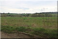
Fields by Benington Road south of Walkern
Image: © David Howard
Taken: 3 Apr 2022
0.20 miles
5

War memorial - Walkern.
Stuck out in rather an odd place. It sits in the grass triangle at a junction just outside of Walkern. There are no houses or other buildings in the immediate vicinity.
Image: © Robin Hall
Taken: 3 Jan 2006
0.23 miles
6
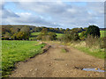
Track towards River Beane
It leads down to some unmapped buildings of impermanent nature and unknown purpose.
Image: © Robin Webster
Taken: 5 Nov 2017
0.25 miles