
IMAGES TAKEN NEAR TO
Town Lane, STEVENAGE, SG2 7BT
Introduction
This page details the photographs taken nearby to Town Lane, SG2 7BT by members of the Geograph project.
The Geograph project started in 2005 with the aim of publishing, organising and preserving representative images for every square kilometre of Great Britain, Ireland and the Isle of Man.

There are currently over 7.5m images from over14,400 individuals and you can help contribute to the project by visiting https://www.geograph.org.uk
Image Map
Images are licensed for reuse under creativecommons.org/licenses/by-sa/2.0
Notes
- Clicking on the map will re-center to the selected point.
- The higher the marker number, the further away the image location is from the centre of the postcode.
Image Listing (8 Images Found)
Images are licensed for reuse under creativecommons.org/licenses/by-sa/2.0
Image
Details
Distance
1
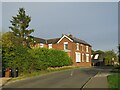
Town Lane, Benington, near Stevenage
Town Lane in the village of Benington, in north Hertfordshire.
Image: © Malc McDonald
Taken: 25 Sep 2022
0.03 miles
2

Roadside placard, Benington, Hertfordshire (1)
While the country struggles to supplement its energy needs by tentatively developing alternative sources, voices of protest in rural areas raised by those affected by these proposed installations. The village of Benington in Hertfordshire currently has a numerous placards along the roadside like the one in the image. A justified campaign http://www.stopbeningtonwindfarm.co.uk/ ? or mere nimbyism http://en.wikipedia.org/wiki/NIMBY ?
Image: © Jim Osley
Taken: 31 Jul 2011
0.06 miles
3

Roadside placard, Benington, Hertfordshire (2)
Image ... and here an apparently lone voice of support for the project!
Image: © Jim Osley
Taken: 31 Jul 2011
0.06 miles
6
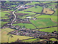
Benington and Burn's Green
Two villages surrounded by farmland east of Stevenage. Burn's Green is the more distant.
Image: © M J Richardson
Taken: 12 Dec 2014
0.15 miles
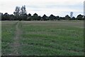
8
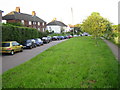
Benington: Town Lane
Looking towards Burn's Green.
Image: © Nigel Cox
Taken: 18 May 2006
0.21 miles