
IMAGES TAKEN NEAR TO
Chalkdown, STEVENAGE, SG2 7BN
Introduction
This page details the photographs taken nearby to Chalkdown, SG2 7BN by members of the Geograph project.
The Geograph project started in 2005 with the aim of publishing, organising and preserving representative images for every square kilometre of Great Britain, Ireland and the Isle of Man.

There are currently over 7.5m images from over14,400 individuals and you can help contribute to the project by visiting https://www.geograph.org.uk
Image Map
Images are licensed for reuse under creativecommons.org/licenses/by-sa/2.0
Notes
- Clicking on the map will re-center to the selected point.
- The higher the marker number, the further away the image location is from the centre of the postcode.
Image Listing (9 Images Found)
Images are licensed for reuse under creativecommons.org/licenses/by-sa/2.0
Image
Details
Distance
1

The White Way, Stevenage, Hertfordshire
Located in East Stevenage, this area being Chells Manor is the edge of Stevenage which the road The White Way leads to a main road called Gresley Way (going East) and behind that is countryside.
The White Way was first built in 1982 when houses started being built the same year up until 1996, the road contains two pathways both sides of the road and 9 bus stops along the road with the local bus route SB1 from Sainsbury’s to Stevenage Town Centre.
The other main road (going Northwest) is called Fairlands Way.
Image: © andy
Taken: 24 Jun 2023
0.19 miles
2
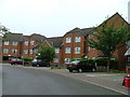
Fortuna Close
One of the more modern parts of Stevenage and with some more imaginative building - three storeys!
Image: © Robin Hall
Taken: 25 Jul 2005
0.21 miles
3

Thorn SONPAK Floodlights (2000) - Emperors Gate Stevenage
Image: © andy
Taken: 3 Nov 2025
0.21 miles
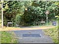
5
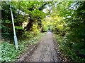
Former Lanterns Lane Stevenage
Located in the Chells Manor Area of Stevenage.
The former Lanterns Lane was once a country lane that was known as a rat run and started at Fairlands Way in Chells Manor and ended in a village near Stevenage called Aston End.
There is two sections that were abandoned and converted into footpaths whilst the other two sections are still in use today as Chells Lane and Lanterns Lane.
The photographed one above is an abandoned section between The White Way and Gresley Way and was converted into a footpath in the 1980s.
Image: © andy
Taken: 6 Aug 2024
0.22 miles
6
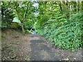
Former Lanterns Lane Stevenage
This abandoned section of country lane now a footpath section shows the pull over lay-by to the left of the former road where cars would pull into to let traffic get past heading the other direction.
Image: © andy
Taken: 6 Aug 2024
0.23 miles
7

LED Street Light Stevenage
The LED Street Lights take over replacing many old Orange SOX Street Lights in the UK.
This particular lamppost in the photograph is located in the Chells Manor ward of Stevenage on The White Way and the lamppost number is 32 just outside the Sweyns Mead Bus Stop which was replaced by the LED Urbis Axia 2 Lantern in October 2017.
The old Lantern was an Orange SOX Eleco GR535 Lantern which was placed here from 1982 until 2017 lasting 35 years of service.
Image: © andy
Taken: 9 Oct 2023
0.25 miles
8

Rescued Sleeping Bee - The White Way Stevenage
I rescued a sleeping Bee on my local walk along The White Way in Stevenage, I took him from the side of the road and moved him onto the pavement next to bushes.
Image: © andy
Taken: 10 Oct 2024
0.25 miles
9

Beats Sticker - Lamppost NO.9 Sweyns Mead - Stevenage
A famous Beats sticker part of the iPhone Apple Inc company that sold Headphones and Bluetooth Speakers (Beats Pill) located on a housing estate in the Chells Manor ward in Stevenage.
Image: © andy
Taken: 9 Jun 2025
0.25 miles