
IMAGES TAKEN NEAR TO
The Glebe, STEVENAGE, SG2 7AJ
Introduction
This page details the photographs taken nearby to The Glebe, SG2 7AJ by members of the Geograph project.
The Geograph project started in 2005 with the aim of publishing, organising and preserving representative images for every square kilometre of Great Britain, Ireland and the Isle of Man.

There are currently over 7.5m images from over14,400 individuals and you can help contribute to the project by visiting https://www.geograph.org.uk
Image Map
Images are licensed for reuse under creativecommons.org/licenses/by-sa/2.0
Notes
- Clicking on the map will re-center to the selected point.
- The higher the marker number, the further away the image location is from the centre of the postcode.
Image Listing (62 Images Found)
Images are licensed for reuse under creativecommons.org/licenses/by-sa/2.0
Image
Details
Distance
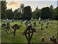
2
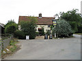
The Jolly Waggoner
Village pub in Ardeley. Has good parking facilities and looks to do a good range of food - Hog Roast planned for Saturday!
Image: © Martin Addison
Taken: 4 Aug 2006
0.03 miles
3
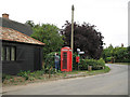
Clipping the Hedge
One of Ardeley's residents gets to grips with his hedge. Post and Telephone boxes by the side of the road along with the roadsign giving directions to Cottered, Wood End, Great Munden, Cromer and Walkern. Unusually, the phonebox is sited with its glass against the hedge and the back facing the road. I suspect that the door would have fouled the pole if it had been positioned the normal way round.
Image: © Martin Addison
Taken: 4 Aug 2006
0.03 miles
4
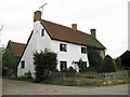
Houses in Ardeley
The white house in this view was once a pub, whilst the pebbled house was a shop. The shop closed in the 1970's.
Image: © Martin Addison
Taken: 4 Aug 2006
0.03 miles
5
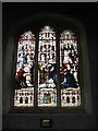
St Lawrence - Ardeley
One of several excellent stained glass windows in this church.
Image: © Martin Addison
Taken: 6 Aug 2006
0.03 miles
6
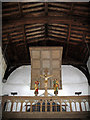
St Lawrence - Ardeley
The Rood Loft with Rood - dates from 1928. The figures are Italian. The roof dates from the 15th century.
Image: © Martin Addison
Taken: 6 Aug 2006
0.03 miles
7
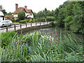
Ardeley Pond
The pond backs onto the churchyard. The wooden rails mark the roadside - there is no footpath. The house opposite dates from 1883. I believe the flowers in the foreground are Purple Loosestrife.
Image: © Martin Addison
Taken: 4 Aug 2006
0.03 miles
8
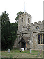
St Lawrence - Ardeley
Church tower and south entrance. The entrance is of brick and timber construction. There are cracks in one of the buttresses, suggesting that the church may be on the move. On the north side there is a more substantial stone entrance and a clock on the tower with a date of 1935. The church itself dates to 1200.
Image: © Martin Addison
Taken: 4 Aug 2006
0.03 miles
9
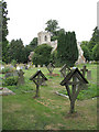
St Lawrence - Ardeley
Parish church of Ardeley, dates to 1200. The tower is of the Hertfordshire Spike variety. The graveyard contains a mix of wood stone and metal monuments.
Image: © Martin Addison
Taken: 4 Aug 2006
0.03 miles
10

St Lawrence's church, Ardeley
The nave dates from C13 or earlier. The chancel and north aisle are also C13 but later. The south aisle is early C14 and the tower was added in C15. The chancel was restored by William Butterfield in 1864 and further restoration was carried out 1880-4.
Image: © Bikeboy
Taken: 10 May 2015
0.04 miles