
IMAGES TAKEN NEAR TO
Wren Close, STEVENAGE, SG2 0AS
Introduction
This page details the photographs taken nearby to Wren Close, SG2 0AS by members of the Geograph project.
The Geograph project started in 2005 with the aim of publishing, organising and preserving representative images for every square kilometre of Great Britain, Ireland and the Isle of Man.

There are currently over 7.5m images from over14,400 individuals and you can help contribute to the project by visiting https://www.geograph.org.uk
Image Map
Images are licensed for reuse under creativecommons.org/licenses/by-sa/2.0
Notes
- Clicking on the map will re-center to the selected point.
- The higher the marker number, the further away the image location is from the centre of the postcode.
Image Listing (6 Images Found)
Images are licensed for reuse under creativecommons.org/licenses/by-sa/2.0
Image
Details
Distance
1
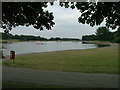
Fairlands Valley Park
This large lake is used by sailors and fishermen. This photo is taken facing south. To the rear there are two smaller lakes. The park is very popular in the summer.
Image: © Robin Hall
Taken: 21 Jul 2005
0.12 miles
3
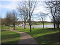
Fairlands Valley Park lake
looking north from the top edge of the large lake
Image: © Jo Hennessey
Taken: 11 Mar 2007
0.12 miles
4
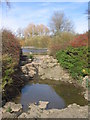
Long way down
Ducks on a stretch of water that is part of Fairlands Park
Image: © Barry Ephgrave
Taken: 17 Jul 2011
0.24 miles
5
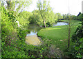
Stevenage: Fairlands Valley Park
The second lake, going downstream, of the four in the park, this is the reverse view from Image
Image: © Nigel Cox
Taken: 18 May 2006
0.24 miles
6
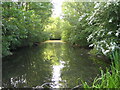
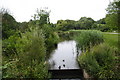
Stevenage: Fairlands Valley Park
The second lake going downstream viewed from the weir to the third lake.
Image: © Nigel Cox
Taken: 18 May 2006
0.24 miles