IMAGES TAKEN NEAR TO
Beechside, SANDY, SG19 3NB
Introduction
This page details the photographs taken nearby to Beechside, SG19 3NB by members of the Geograph project.
The Geograph project started in 2005 with the aim of publishing, organising and preserving representative images for every square kilometre of Great Britain, Ireland and the Isle of Man.

There are currently over 7.5m images from over14,400 individuals and you can help contribute to the project by visiting https://www.geograph.org.uk
Image Map
Images are licensed for reuse under creativecommons.org/licenses/by-sa/2.0
Notes
- Clicking on the map will re-center to the selected point.
- The higher the marker number, the further away the image location is from the centre of the postcode.
Image Listing (12 Images Found)
Images are licensed for reuse under creativecommons.org/licenses/by-sa/2.0
Image
Details
Distance
1
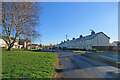
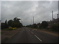
Gamlingay: on Cinques Road
The terraces on the right are, I think, inter-wars council-built houses of a style found elsewhere in Cambridgeshire.
Image: © John Sutton
Taken: 8 Dec 2022
0.04 miles
3
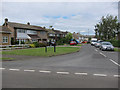
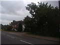
Gamlingay: a stinkpipe on Green End
The sewer vent pipe on the left is the concrete-cased type found in a number of Cambridgeshire villages. In the middle distance in the centre of the picture is a former Methodist Chapel, built in the 1850s, which now houses a pre-school.
Image: © John Sutton
Taken: 8 Dec 2022
0.18 miles
6
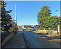
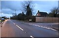
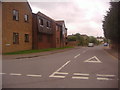
Waresley Road, Gamlingay
Brockwood Close is on the right
Image: © David Howard
Taken: 31 May 2012
0.20 miles
8
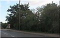
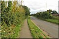
Road blockage on Waresley Road, Gamlingay
Unlike road humps which wear out your suspension and damage the underside of your car every time you go over them these force traffic on the wrong side of the road, meaning sooner or later someone, maybe a foreign tourist unfamiliar with such issues, will have a head on collision. The council however make sure each way by having both on around a mile long stretch of road. This includes articulated lorries and buses, so not just punishing car users which is the main aim of such measures. And of course emergency vehicles. In London where I live they reckon a certain extra number of people die every year due to ambulances unable to drive over 20 mph or so over road humps, as well as drips and other equipment coming loose.
Image: © David Howard
Taken: 31 May 2012
0.23 miles
10
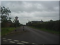
Green End from the junction of Waresley Road
Image: © David Howard
Taken: 31 May 2012
0.23 miles