IMAGES TAKEN NEAR TO
Woodhall Park, HERTFORD, SG14 3NR
Introduction
This page details the photographs taken nearby to Woodhall Park, SG14 3NR by members of the Geograph project.
The Geograph project started in 2005 with the aim of publishing, organising and preserving representative images for every square kilometre of Great Britain, Ireland and the Isle of Man.

There are currently over 7.5m images from over14,400 individuals and you can help contribute to the project by visiting https://www.geograph.org.uk
Image Map (Loading...)


Getting Data...Please wait
Leaflet Map data © OpenStreetMap
Images are licensed for reuse under creativecommons.org/licenses/by-sa/2.0
Notes
- Clicking on the map will re-center to the selected point.
- The higher the marker number, the further away the image location is from the centre of the postcode.
Image Listing (9 Images Found)
Images are licensed for reuse under creativecommons.org/licenses/by-sa/2.0
Image
Details
Distance
1
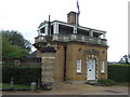
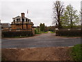
Hertford Lodge East
Gate house to Woodhall Park.
Image: © JThomas
Taken: 27 Jul 2019
0.01 miles
2
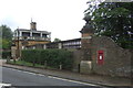
Hertford Lodge East
Showing position of Postbox No. SG14 59.
See Image] for postbox.
Image: © JThomas
Taken: 27 Jul 2019
0.01 miles
3
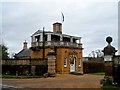
Hertford Lodge
Gate house built in 1870 (see http://www.britishlistedbuildings.co.uk/en-356329-hetford-lodge-east-watton-at-stone-hertf for entry in British Listed Buildings) to Woodhall Park. The main house was built 1777-82 for Sir Thomas Rumbold. Rumbold (1736-91) was an employee of the East India Company and later a rather corrupt politician. He was involved in election bribery scandals and accusations of embezzlement from the East India Company.
Image: © Bikeboy
Taken: 22 Dec 2014
0.01 miles
4
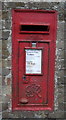
George VI postbox, Hertford Lodge East
Postbox No. SG14 59.
See Image] for context.
Image: © JThomas
Taken: 27 Jul 2019
0.02 miles
5
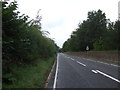
Entrance to Woodhall park
Impressive gate lodge at the park entrance.
Image: © Michael Trolove
Taken: 6 Apr 2014
0.02 miles
8
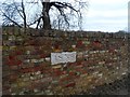
Date marker on wall to Woodhall Park
1838. The parkland was set out when Woodhall House was built in the late C18.
Image: © Bikeboy
Taken: 22 Dec 2014
0.18 miles
9
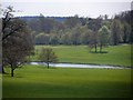
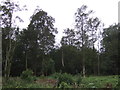
Broad Water and park land near The Heath school
Broad Water is a widening of the River Beane
Image: © Bikeboy
Taken: 6 May 2013
0.19 miles