
IMAGES TAKEN NEAR TO
Stanmore Road, STEVENAGE, SG1 3QF
Introduction
This page details the photographs taken nearby to Stanmore Road, SG1 3QF by members of the Geograph project.
The Geograph project started in 2005 with the aim of publishing, organising and preserving representative images for every square kilometre of Great Britain, Ireland and the Isle of Man.

There are currently over 7.5m images from over14,400 individuals and you can help contribute to the project by visiting https://www.geograph.org.uk
Image Map
Images are licensed for reuse under creativecommons.org/licenses/by-sa/2.0
Notes
- Clicking on the map will re-center to the selected point.
- The higher the marker number, the further away the image location is from the centre of the postcode.
Image Listing (61 Images Found)
Images are licensed for reuse under creativecommons.org/licenses/by-sa/2.0
Image
Details
Distance
1
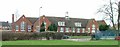
Letchmore infants and nursery school. Letchmore Rd, Stevenage
One of Stevenage's many, many schools.
Image: © Robin Hall
Taken: 19 Jan 2006
0.10 miles
3
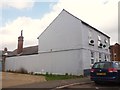
Former Prince of Wales pub
In Albert Street, Stevenage.
Image: © David960
Taken: 2 Oct 2014
0.11 miles
4
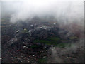
Stevenage from the air
Stevenage was the first land visible through the dense blanket of cloud that extended to the North Sea where the flight from Prague passed over Orford Ness.
The D shaped recreation ground at Letchworth Road can be seen in the foreground, with Bury Mead park more prominent in the centre. Lister Hospital is visible just above the centre.
Image: © Thomas Nugent
Taken: 15 Mar 2013
0.11 miles
5
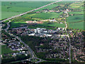
Northwest Stevenage from the air
The roundabout is on the A1072 at the A602. Lister Hospital dominates the scene. Viewed from a Luton bound flight from Prague.
Image: © Thomas Nugent
Taken: 11 May 2012
0.11 miles
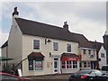
7
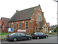
Bunyan Baptist Church. Basil's Road, Stevenage.
Dominates this open space on the corner of a couple of streets.
Image: © Robin Hall
Taken: 19 Jan 2005
0.12 miles
8
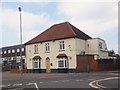
Former White Horse pub, Stevenage
On the corner of Letchmore Road and Albert Street.
Image: © David960
Taken: 2 Oct 2014
0.12 miles
9
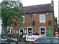
The Standing Order, Stevenage Old Town
Before it was a pub this building housed a bank, hence the name "The Standing Order".
Image: © Ken Ripper
Taken: 27 Jun 2008
0.13 miles
10
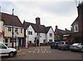
NatWest Bank, Stevenage Old Town
Once the Old Castle public house, and site of Henry Trigg's coffin: http://openplaques.org/plaques/1954
Image: © David960
Taken: 2 Oct 2014
0.13 miles