
IMAGES TAKEN NEAR TO
The Finches, HERTFORD, SG13 7TB
Introduction
This page details the photographs taken nearby to The Finches, SG13 7TB by members of the Geograph project.
The Geograph project started in 2005 with the aim of publishing, organising and preserving representative images for every square kilometre of Great Britain, Ireland and the Isle of Man.

There are currently over 7.5m images from over14,400 individuals and you can help contribute to the project by visiting https://www.geograph.org.uk
Image Map
Images are licensed for reuse under creativecommons.org/licenses/by-sa/2.0
Notes
- Clicking on the map will re-center to the selected point.
- The higher the marker number, the further away the image location is from the centre of the postcode.
Image Listing (7 Images Found)
Images are licensed for reuse under creativecommons.org/licenses/by-sa/2.0
Image
Details
Distance
2
Vixen Drive, Hertford
From the roundabout on Stansted Road
Image: © David Howard
Taken: 14 Apr 2019
0.14 miles
3
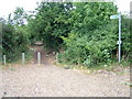
Public footpath near Rush Green Roundabout
This public footpath to Rush Green and Hertford Heath follows part of the course of an old Roman Road, Ermine Street.
Image: © Rob Candlish
Taken: 26 Jul 2010
0.17 miles
4
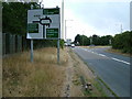
Road sign on the approach to Rush Green Roundabout
Like Amwell Roundabout, Rush Green Roundabout also has a grid square boundary passing through it. The white van at the head of the queue of traffic waiting to get onto the roundabout is just about to enter grid square Image
Image: © Rob Candlish
Taken: 26 Jul 2010
0.21 miles
5
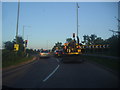
Exiting the A10 in Ware
Turning right on the A414 to Hertford
Image: © David Howard
Taken: 26 Jul 2012
0.22 miles
7

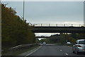
Roundabout on the A414 going above the A10, Ware
Leaving the A10 for Hertford
Image: © David Howard
Taken: 13 Jun 2012
0.24 miles