
IMAGES TAKEN NEAR TO
Woodland Mount, HERTFORD, SG13 7JD
Introduction
This page details the photographs taken nearby to Woodland Mount, SG13 7JD by members of the Geograph project.
The Geograph project started in 2005 with the aim of publishing, organising and preserving representative images for every square kilometre of Great Britain, Ireland and the Isle of Man.

There are currently over 7.5m images from over14,400 individuals and you can help contribute to the project by visiting https://www.geograph.org.uk
Image Map
Images are licensed for reuse under creativecommons.org/licenses/by-sa/2.0
Notes
- Clicking on the map will re-center to the selected point.
- The higher the marker number, the further away the image location is from the centre of the postcode.
Image Listing (10 Images Found)
Images are licensed for reuse under creativecommons.org/licenses/by-sa/2.0
Image
Details
Distance
1

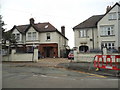
Old Milestone by the A119, Ware Road, Hertford
Stone post (plate lost) by the A119, in parish of Hertford (East Hertfordshire District), Ware Road, at junction with Fairfax Road, built into wall, on West side of road. Hertford stone, erected by the Cheshunt turnpike trust in the 19th century.
Inscription once read:-
(LONDON)
(22)
Hertfordshire HER & St Albans UAD.
HHER Number: 11985 https://www.heritagegateway.org.uk/Gateway/Results_Single.aspx?uid=MHT11985&resourceID=1008
Milestone Society National ID: HE_XX22
Image: © MW Hallett
Taken: 13 Mar 2004
0.07 miles
3
Ware Road, Hertford
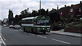
Looking along the A119 towards the Police Station from near to the junction with Fairfax Road. The houses along the south side of the road are set back with long front gardens and raised above street level.
A London Country AEC Reliance with Park Royal body makes its way into Hertford on the 337 service from Buntingford via Standon, Puckeridge Wadesmill and Ware. This class of vehicles, the RP's, were introduced in 1972 to replace Routemaster coaches on London Country's Green Line express routes. But by 1979 when this photo was taken they were being displaced by coach bodied reliances like the one seen in the distance. This particular vehicle - RP31 - is quite rare as it was one of only three of the 90 strong type to be repainted in National Bus Company bus livery.
Image: © Martin Addison
Taken: Unknown
0.08 miles
4
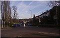
Roundabout on Ware Road
Looking along Stanstead Road
Image: © David Howard
Taken: 24 Mar 2011
0.09 miles

8

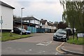
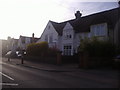
A119 Ware Road, Hertford
Heading towards Ware.
Image: © Robin Webster
Taken: 17 Feb 2019
0.14 miles
9
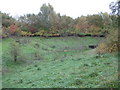
Hertford: Braziers Field Flood Storage Area
Management of watercourses to alleviate the effects of flooding often entails building flood storage areas where the water can be impounded and let down the stream or river in a controlled manner. This small storage area impounds water from Braziers Field Drain. 1960s Ordnance Survey maps show that the drain then ran in an open channel down Braziers Field road, before joining with Rowleys Road Drain at the top end of Foxholes Avenue. The joined up stream then ran down the middle of that road. Today most of the watercourses in this area are culverted and out of sight.
Image: © Nigel Cox
Taken: 29 Oct 2010
0.16 miles
10
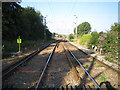
Hertford: Railway line
Looking towards Hertford East railway station from the pedestrian crossing between Mead Lane and Rowleys Road.
Image: © Nigel Cox
Taken: 24 Jul 2006
0.23 miles