
IMAGES TAKEN NEAR TO
London Road, WARE, SG12 9JF
Introduction
This page details the photographs taken nearby to London Road, SG12 9JF by members of the Geograph project.
The Geograph project started in 2005 with the aim of publishing, organising and preserving representative images for every square kilometre of Great Britain, Ireland and the Isle of Man.

There are currently over 7.5m images from over14,400 individuals and you can help contribute to the project by visiting https://www.geograph.org.uk
Image Map
Images are licensed for reuse under creativecommons.org/licenses/by-sa/2.0
Notes
- Clicking on the map will re-center to the selected point.
- The higher the marker number, the further away the image location is from the centre of the postcode.
Image Listing (203 Images Found)
Images are licensed for reuse under creativecommons.org/licenses/by-sa/2.0
Image
Details
Distance
1
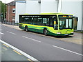
London Road, Ware
Arriva East Herts & Essex Mercedes Citaro number 3901 on the once a day, Monday to Friday only 726 Green Line service to Watford. The white building behind is a new extension to the local college. The red brick building in the background is Amwell House, built in around 1750.
Amwell End and the railway level crossing are directly opposite Amwell House out of shot to the left.
726 is a most unusual route, since it runs once a day in one direction only on Mondays to Fridays only.
Image: © Rob Candlish
Taken: 19 Jul 2010
0.01 miles
2
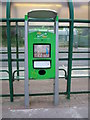
An ePIP in London Road, Ware
A Hertfordshire County Council ePIP (electronic Passenger Information Point) behind the shelter for bus stop A in London Road. As well as giving travel information ePIPs also provide free internet access.
Image: © Rob Candlish
Taken: 19 Jul 2010
0.02 miles
3
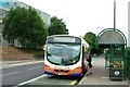
London Road, Ware
Centrebus 748, a Scania L94UB with a Wrights Solar body, picking up a passenger at Stop C in London Road, Ware. In the background is the local college. Route C4 runs on Sundays only.
Image: © Rob Candlish
Taken: 18 Jul 2010
0.02 miles
4
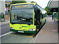
London Road, Ware
Arriva East Herts & Essex Mercedes Citaro number 3903 on the infrequent Green Line route 725 from St Albans waiting at Stop C in London Road with the Ware Campus of Hertford Regional College in the background.
Image: © Rob Candlish
Taken: 23 Jul 2010
0.03 miles
5
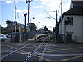
Ware railway station
Looking from Ware Level Crossing, the track is singled through the station.
Image: © Nigel Cox
Taken: 21 Jun 2006
0.03 miles
6
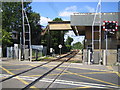
Ware Level Crossing
The Amwell End level crossing to the west of Ware station looking in the direction of Hertford East station. The track is singled through Ware station.
Image: © Nigel Cox
Taken: 21 Jun 2006
0.03 miles
7
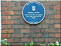
Blue plaque on Amwell House, London Road
The blue plaque placed by Ware Town Council on Amwell House, London Road. A number of other buildings in the town have these plaques as well, including Place House off East Street, the railway station, the old Town Hall and the public library.
Image: © Rob Candlish
Taken: 16 Jul 2010
0.03 miles
8
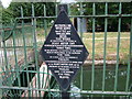
Old Metropolitan Water Board sign
The Metropolitan Water Board was formed in 1903 to unify London's water suppliers. It took over the New River Company and thereby became responsible for the New River. The Board itself was absorbed into the Thames Water Authority in 1973. The New River is now the responsibility of the Environment Agency. This sign has done well to survive.
Image: © Rob Candlish
Taken: 23 Jul 2010
0.03 miles
9
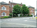
Amwell House, London Road, Ware
Amwell House was built in about 1750 for the Quaker poet John Scott and his father. It later housed Ware Grammar School for Girls until that moved to a new site in Hoe Lane. It is now part of the Ware Campus of Hertford Regional College.
Over 30 years ago the wings on either side of the building were shortened to allow London Road to be widened. They were originally about twice their present length.
Image: © Rob Candlish
Taken: 26 Jul 2010
0.04 miles
10
Hertford Road, Ware
Alongside the River Lea
Image: © David Howard
Taken: 10 Jul 2014
0.04 miles