
IMAGES TAKEN NEAR TO
Bridgefoot, WARE, SG12 9DW
Introduction
This page details the photographs taken nearby to Bridgefoot, SG12 9DW by members of the Geograph project.
The Geograph project started in 2005 with the aim of publishing, organising and preserving representative images for every square kilometre of Great Britain, Ireland and the Isle of Man.

There are currently over 7.5m images from over14,400 individuals and you can help contribute to the project by visiting https://www.geograph.org.uk
Image Map
Images are licensed for reuse under creativecommons.org/licenses/by-sa/2.0
Notes
- Clicking on the map will re-center to the selected point.
- The higher the marker number, the further away the image location is from the centre of the postcode.
Image Listing (242 Images Found)
Images are licensed for reuse under creativecommons.org/licenses/by-sa/2.0
Image
Details
Distance
1

River Lea in Ware
View downstream from the town bridge.
Image: © Des Blenkinsopp
Taken: 13 Sep 2012
0.02 miles
2
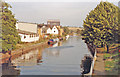
Ware: eastward on River Lea Navigation, 1990
View eastwards, downstream from the A1170 bridge.
Image: © Ben Brooksbank
Taken: 2 Sep 1990
0.02 miles
3
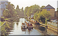
Ware: westward on River Lea Navigation, 1990
View upstream from A1170 bridge, towards Hertford.
Image: © Ben Brooksbank
Taken: 2 Sep 1990
0.02 miles
4
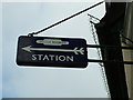
Old British Railways sign in Ware High Street
A British Railways direction sign from the 1950s still on a shop front in Ware High Street today.
Image: © Rob Candlish
Taken: 16 Jun 2010
0.02 miles
5

Buildings on High Street, Ware
Both are grade II listed, although the Milady ship front is 1920s, it fronts an older part behind.
Image: © Robin Webster
Taken: 17 Feb 2019
0.02 miles
6
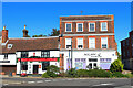
Coffee House
Milady tea & coffee lounge in Ware.
Image: © Wayland Smith
Taken: 15 Oct 2023
0.02 miles
7
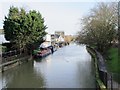
The River Lea (or Lee) east of the bridge at Amwell End, SG12
Image: © Mike Quinn
Taken: 14 Jan 2015
0.02 miles
9
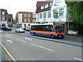
The Town Bridge, Ware
A Centrebus Optare Solo about to cross the Town Bridge from the High Street side with a once a day journey to County Hall, Hertford on route 384. Just past "The Navigator" public house on the right is Star Street. The High Street is off the mini-roundabout to the left.
Before it became a public house "The Navigator" was the head office of a package tour operator. Before that it was the local show room for the Eastern Electricity Board, for whom it was originally built.
Image: © Rob Candlish
Taken: 23 Jul 2010
0.03 miles
