
IMAGES TAKEN NEAR TO
Hanbury Mews, Hanbury Drive, WARE, SG12 0UB
Introduction
This page details the photographs taken nearby to Hanbury Mews, Hanbury Drive, SG12 0UB by members of the Geograph project.
The Geograph project started in 2005 with the aim of publishing, organising and preserving representative images for every square kilometre of Great Britain, Ireland and the Isle of Man.

There are currently over 7.5m images from over14,400 individuals and you can help contribute to the project by visiting https://www.geograph.org.uk
Image Map
Images are licensed for reuse under creativecommons.org/licenses/by-sa/2.0
Notes
- Clicking on the map will re-center to the selected point.
- The higher the marker number, the further away the image location is from the centre of the postcode.
Image Listing (8 Images Found)
Images are licensed for reuse under creativecommons.org/licenses/by-sa/2.0
Image
Details
Distance
3
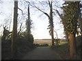
View from Poles Lane, Thundridge
This is across a golf course which was a gravel pit. Here are some details http://www.pentalocal.uk/england/thundridge/gravelpit-plantation/
Image: © David Howard
Taken: 16 Feb 2016
0.09 miles
4
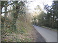
Poles Lane, Thundridge
This road used to lead to Poles School which is now Hanbury Manor Health Club
Image: © David Howard
Taken: 16 Feb 2016
0.11 miles
5
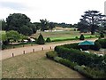
Golf Course, Hanbury Manor, Wadesmill, Herts
Image: © John Salmon
Taken: 6 Aug 2006
0.14 miles
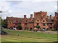
7
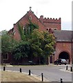
Chapel, Hanbury Manor, Wadesmill, Herts
Now part of a Hotel.
Image: © John Salmon
Taken: 6 Aug 2006
0.15 miles
8
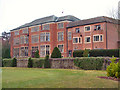
Hanbury Manor
Originally a Jacobean style mansion built in 1890 by Edmond Hanbury, it then became a convent, and is now a Five Star Hotel & Country Club with an eighteen hole Golf Course.
Image: © Melvyn Cousins
Taken: 17 Mar 2006
0.19 miles