
IMAGES TAKEN NEAR TO
Millfield, WARE, SG12 0TU
Introduction
This page details the photographs taken nearby to Millfield, SG12 0TU by members of the Geograph project.
The Geograph project started in 2005 with the aim of publishing, organising and preserving representative images for every square kilometre of Great Britain, Ireland and the Isle of Man.

There are currently over 7.5m images from over14,400 individuals and you can help contribute to the project by visiting https://www.geograph.org.uk
Image Map
Images are licensed for reuse under creativecommons.org/licenses/by-sa/2.0
Notes
- Clicking on the map will re-center to the selected point.
- The higher the marker number, the further away the image location is from the centre of the postcode.
Image Listing (27 Images Found)
Images are licensed for reuse under creativecommons.org/licenses/by-sa/2.0
Image
Details
Distance
1
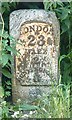
Old Milestone by the former A10, Wadesmill, Thundridge parish
Metal plate attached to stone post by the A10, in parish of THUNDRIDGE (EAST HERTFORDSHIRE District), Wadesmill, North of junction with Youngsbury Lane, in verge behind pavement (under lamppost), on West side of road. Wadesmill plate, erected by the Wadesmill turnpike trust in the 19th century.
Inscription reads:-
LONDON
23
WARE
2
BUNTINGFORD
8
Grade II listed.
List Entry Number: 1078713 https://historicengland.org.uk/listing/the-list/list-entry/1078713
Milestone Society National ID: HE_LK23.
Image: © MW Hallett
Taken: 24 Mar 2003
0.06 miles
2
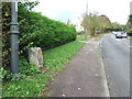
Old Milepost
Old milepost on what was the A.10 at Wadesmill, Hertfordshire for close up view see http://www.geograph.org.uk/photo/3207502
Image: © Keith Evans
Taken: 1 Nov 2012
0.07 miles
3
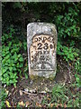
Old Milepost
Old milepost on what was the A.10 at Wadesmill, Hertfordshire for overall view see http://www.geograph.org.uk/photo/3207494
Image: © Keith Evans
Taken: 1 Nov 2012
0.07 miles
4
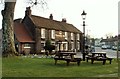
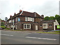
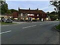
'The Feathers Inn' at Wadesmill
This was originally a 17th century coaching inn and called 'The Princes Arms' in the early 1600s.
Image: © Robert Edwards
Taken: 20 Mar 2009
0.08 miles
5
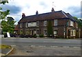
"The Feathers Inn" public house, Wadesmill
This is a Grade II listed building, described at this https://historicengland.org.uk/listing/the-list/list-entry/1204080.
Image: © Jim Osley
Taken: 30 Jul 2016
0.08 miles
8
Information Board
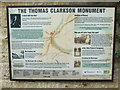
Information board for the Thomas Clarkson monument next to what was the A10 near to Wadesmill, Hertfordshire. For views of the monument see http://www.geograph.org.uk/photo/3207446
http://www.geograph.org.uk/photo/3207443
Image: © Keith Evans
Taken: 1 Nov 2012
0.13 miles
9
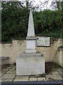
The Thomas Clarkson Monument
The Thomas Clarkson monument next to what was the A10 near to Wadesmill, Hertfordshire. For info on the monument and how it came to be built here see for other view see http://www.geograph.org.uk/photo/3207443 http://www.geograph.org.uk/photo/3207451
Image: © Keith Evans
Taken: 1 Nov 2012
0.13 miles
10
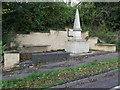
The Thomas Clarkson Monument
The Thomas Clarkson monument next to what was the A10 near to Wadesmill, Hertfordshire. For info on the monument and how it came to be built here see http://www.geograph.org.uk/photo/3207451 for other view see http://www.geograph.org.uk/photo/3207446
Image: © Keith Evans
Taken: 1 Nov 2012
0.13 miles