IMAGES TAKEN NEAR TO
The Forum, STEVENAGE, SG1 1EJ

Introduction

This page details the photographs taken nearby to The Forum, SG1 1EJ by members of the Geograph project.

The Geograph project started in 2005 with the aim of publishing, organising and preserving representative images for every square kilometre of Great Britain, Ireland and the Isle of Man.

There are currently over 7.5m images from over14,400 individuals and you can help contribute to the project by visiting https://www.geograph.org.uk

Image Map


Images are licensed for reuse under creativecommons.org/licenses/by-sa/2.0
Notes
  • Clicking on the map will re-center to the selected point.
  • The higher the marker number, the further away the image location is from the centre of the postcode.

Image Listing (135 Images Found)

Images are licensed for reuse under creativecommons.org/licenses/by-sa/2.0
  • ...
Image
Details
Distance
1
Tesco Stevenage
Image: © Andrew Tatlow Taken: 5 Apr 2010
0.07 miles
2
Swingate House
Swingate House: Photo taken on 17/08/2021 A former 1960s office building in Stevenage Town Centre now demolished as of March 2022 as part of the Regeneration Project by Stevenage Borough Council to demolish old buildings around the Town Centre for new build homes and businesses.
Image: © Andy Steele Taken: 17 Aug 2021
0.07 miles
3
Autolus Stevenage
Located on Marshgate in Stevenage. Construction started in May 2022 and a completion in August 2023 with an opening in September 2023 Autolus have had a new block up to 4 storeys in height (Ground Floor - 3rd Floor). The building is a new science technology block and the building having spaced out floors is the equivalent height of a 10 storey building and one of the first and tallest new builds in Stevenage as part of the Regeneration Scheme by Stevenage Borough Council.
Image: © Andy Steele Taken: 21 Aug 2023
0.07 miles
4
Tesco's, Stevenage
Image: © N Chadwick Taken: 25 Feb 2011
0.08 miles
5
Staples office supplies
Image: © Andrew Tatlow Taken: 5 Apr 2010
0.08 miles
6
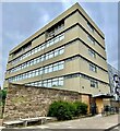
Brickdale House
Brickdale House or what was once originally known as the DHSS (Department for Health Social Security) and the HM Land Registry Offices. The building was in use from 1966 to 2011, the building was built in 4 stages with the last stage completed in 1989, the building is located in Stevenage Town Centre on Swingate & Danestrete. After the relocation of the DHSS which would later become the DWP (Department for Work & Pensions) and the unfortunate closure of the HM Land Registry for Stevenage Offices the building would remain derelict and empty for 4 years until 2015 when renovations and conversions of the complex from Offices to Apartments. The building was split into two different buildings, in the photo above the building with balconies with a grey, purple and white block design kept the original building name Brickdale House and the blue & white block alongside the brown block was renamed to Skyline House. In total Brickdale House with the extra two storey extension built during the conversion has a total of 54 flats and Skyline House has a total of 150 flats, altogether the entire complex has a total of 204 flats.
Image: © Andy Steele Taken: 17 Apr 2023
0.08 miles
7
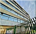
Stevenage HM Land Registry (Former Offices)
Located on Swingate/Danestrete in Stevenage Town Centre. Originally built in 1966 as Brickdale House for the HM Land Registry until closing in 2011, converted and refurbished into 150 Flats and renamed to Skyline House opening in 2017 for residential use.
Image: © Andy Steele Taken: 2 Sep 2023
0.08 miles
8
Swingate House Stevenage
Taken from the disused delivery entrance outside the South Side of Swingate House in Stevenage. The photo showing the South Side of Swingate House in July 2021. Built in 1962, opened in 1963, closed in 2020, demolished in 2022.
Image: © Andy Steele Taken: 1 Jul 2021
0.08 miles
9
Demolished Swingate House Site Stevenage
Located in Stevenage Town Centre. The remaining old footprint that once stood Swingate House which was demolished in 2022 to make way for new Apartments up to 10 storeys high renamed to Northern Quarter.
Image: © Andy Steele Taken: 11 May 2024
0.08 miles
10
Tesco fuel
Image: © Andrew Tatlow Taken: 5 Apr 2010
0.08 miles
  • ...