
IMAGES TAKEN NEAR TO
Hull Lane, WARE, SG11 2PF
Introduction
This page details the photographs taken nearby to Hull Lane, SG11 2PF by members of the Geograph project.
The Geograph project started in 2005 with the aim of publishing, organising and preserving representative images for every square kilometre of Great Britain, Ireland and the Isle of Man.

There are currently over 7.5m images from over14,400 individuals and you can help contribute to the project by visiting https://www.geograph.org.uk
Image Map
Images are licensed for reuse under creativecommons.org/licenses/by-sa/2.0
Notes
- Clicking on the map will re-center to the selected point.
- The higher the marker number, the further away the image location is from the centre of the postcode.
Image Listing (55 Images Found)
Images are licensed for reuse under creativecommons.org/licenses/by-sa/2.0
Image
Details
Distance
1
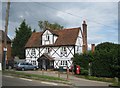
Braughing: Post Office and H & N Jones, grocers
This building has an interesting history. Built with a timber frame in the 17th Century, it was once a pub called the Bell, and an example of the eponymous item still hangs under the front porch. It was Gothicised by the brewers that owned it in 1874, but ceased trading as a pub around 1926. Along with most of the other old buildings in the village it is Grade II Listed.
Image: © Nigel Cox
Taken: 19 Jun 2011
0.09 miles

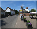
4
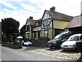
The Gables, Braughing
On a village open garden day.
Image: © Roger Cornfoot
Taken: 19 Jun 2011
0.11 miles
6
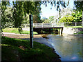
Bridge over the Braughing Bourne
As seen from the ford, with the depth gauge on the left.
Image: © Christine Matthews
Taken: 23 May 2010
0.16 miles
7
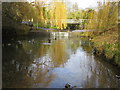
Braughing: Maltings Lane ford
The ford, which is above the weir, allows Maltings Lane traffic to pass over the River Quin. Also visible are the footbridge, a water depth level gaugeboard, and the omnipresent ducks.
Image: © Nigel Cox
Taken: 25 Nov 2007
0.17 miles
8
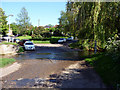
Braughing Ford
Looking towards Braughing Ford from the west.
Image: © Christine Matthews
Taken: 23 May 2010
0.17 miles
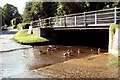
10
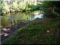
Braughing Bourne
Looking downstream from the ford.
Image: © Christine Matthews
Taken: 23 May 2010
0.17 miles