
IMAGES TAKEN NEAR TO
The Bourne, WARE, SG11 2JD
Introduction
This page details the photographs taken nearby to The Bourne, SG11 2JD by members of the Geograph project.
The Geograph project started in 2005 with the aim of publishing, organising and preserving representative images for every square kilometre of Great Britain, Ireland and the Isle of Man.

There are currently over 7.5m images from over14,400 individuals and you can help contribute to the project by visiting https://www.geograph.org.uk
Image Map
Images are licensed for reuse under creativecommons.org/licenses/by-sa/2.0
Notes
- Clicking on the map will re-center to the selected point.
- The higher the marker number, the further away the image location is from the centre of the postcode.
Image Listing (17 Images Found)
Images are licensed for reuse under creativecommons.org/licenses/by-sa/2.0
Image
Details
Distance
1
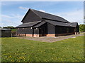
The Village Hall
Built in the vernacular style of black painted wooden barns of this region.
Image: © Michael Trolove
Taken: 12 May 2013
0.00 miles
2
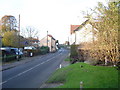
Clapgate
Clapgate village viewed looking northwards towards the crossroads. This is an inadvertent near-repeat of an old photo on the Albury Village website, http://www.alburyvillage.org.uk/images/Clapgate%20crossroads%20looking%20North.jpg with the building on the right showing in both.
Image: © Nigel Cox
Taken: 19 Nov 2005
0.05 miles
3
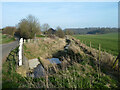
River Ash
Looking downstream from The Parsonage Lane bridge. There was formerly a ford here.
Image: © Robin Webster
Taken: 13 Mar 2014
0.05 miles
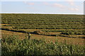
5
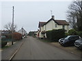
Albury Road, Clapgate, near Albury
Albury Road passing through the hamlet of Clapgate in rural north Hertfordshire.
Image: © Malc McDonald
Taken: 25 Jan 2020
0.10 miles
7
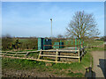
Pumping station by River Ash
A borehole, the river here normally has hardly any water in it now.
Image: © Robin Webster
Taken: 13 Mar 2014
0.11 miles
8
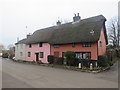
Thatched cottages in Clapgate, near Albury
Thatched cottages in the hamlet of Clapgate in north Hertfordshire.
Image: © Malc McDonald
Taken: 25 Jan 2020
0.11 miles
9
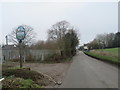
Albury Road, Clapgate, near Albury
The Albury village sign stands next to Albury Road as the road enters the hamlet of Clapgate.
Image: © Malc McDonald
Taken: 25 Jan 2020
0.11 miles
10
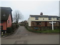
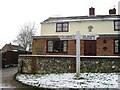
Road junction in Clapgate, near Albury
A road junction in the hamlet of Clapgate in north Hertfordshire. A traditional wooden direction sign stands to the right of the image.
Image: © Malc McDonald
Taken: 25 Jan 2020
0.11 miles