
IMAGES TAKEN NEAR TO
Old Hall Green, WARE, SG11 1HA
Introduction
This page details the photographs taken nearby to SG11 1HA by members of the Geograph project.
The Geograph project started in 2005 with the aim of publishing, organising and preserving representative images for every square kilometre of Great Britain, Ireland and the Isle of Man.

There are currently over 7.5m images from over14,400 individuals and you can help contribute to the project by visiting https://www.geograph.org.uk
Image Map
Images are licensed for reuse under creativecommons.org/licenses/by-sa/2.0
Notes
- Clicking on the map will re-center to the selected point.
- The higher the marker number, the further away the image location is from the centre of the postcode.
Image Listing (5 Images Found)
Images are licensed for reuse under creativecommons.org/licenses/by-sa/2.0
Image
Details
Distance
1
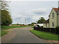
Lane near Puckeridge
An un-named lane in the north Hertfordshire countryside.
Image: © Malc McDonald
Taken: 25 Sep 2022
0.01 miles
3
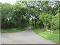
Stockalls Lane, near Great Munden
Stockalls Lane is a minor lane through north Hertfordshire countryside.
Image: © Malc McDonald
Taken: 25 Sep 2022
0.10 miles
4
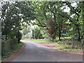
Beggarman's Lane, near Puckeridge
Beggarman's Lane is a minor lane through Hertfordshire countryside. The blue sign indicates it is a no through road for vehicles, while the triangular sign warns drivers to look out for pedestrians walking in the road. The signpost alongside indicates the route of a public footpath to the nearby village of Dane End.
Image: © Malc McDonald
Taken: 25 Sep 2022
0.14 miles
5
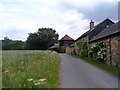
Hatchett Farm
The building with the pyramidal roof was originally a granary. See http://www.britishlistedbuildings.co.uk/en-161311-granary-at-hattchett-farm-40-metres-to-w#.VYcjOPlViko for entry in British Listed Buildings.
Image: © Bikeboy
Taken: 21 Jun 2015
0.17 miles