IMAGES TAKEN NEAR TO
Gregory Crescent, LONDON, SE9 5RT
Introduction
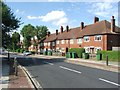
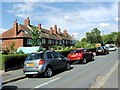
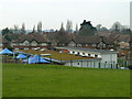
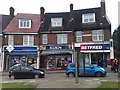
This page details the photographs taken nearby to Gregory Crescent, SE9 5RT by members of the Geograph project.
The Geograph project started in 2005 with the aim of publishing, organising and preserving representative images for every square kilometre of Great Britain, Ireland and the Isle of Man.

There are currently over 7.5m images from over14,400 individuals and you can help contribute to the project by visiting https://www.geograph.org.uk
Image Map
Images are licensed for reuse under creativecommons.org/licenses/by-sa/2.0
Notes
- Clicking on the map will re-center to the selected point.
- The higher the marker number, the further away the image location is from the centre of the postcode.
Image Listing (55 Images Found)
Images are licensed for reuse under creativecommons.org/licenses/by-sa/2.0
Image
Details
Distance
3
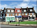
Vista Field Children's Centre
A view from above, from a public open space which might be called Vista Field. The road beyond the centre and in front of the houses is certainly called The Vista. The field has far better vistas than the road.
Image: © Robin Webster
Taken: 4 Feb 2012
0.08 miles
5
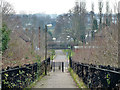
King John's Walk
A path used by the Green Chain Walk and Capital Ring.
Image: © Robin Webster
Taken: 4 Feb 2012
0.11 miles
7

The approach to Sidcup Road Grassland
Sidcup Road Grassland is also known as the Great Meadow, and the approach here looks like it is the depths of the countryside. However, Sidcup Road is the busy A20 which is away to the left and the railway between Mottingham and Lee is in a cutting beyond the trees to the right.
Image: © Marathon
Taken: 16 Jul 2010
0.11 miles
8
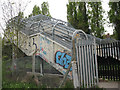
Railway footbridge off Joan Crescent
The bridge links Joan Crescent on the north side of the railway with King John's Walk on the south side. The graffiti tags and security fences give a false impression of the area, which seems generally a pleasant one.
Image: © Stephen Craven
Taken: 16 Apr 2011
0.12 miles
9
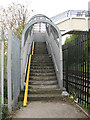
Cycle channels to a footbridge
The bridge is the one seen in Image Presumably as there was insufficient space for ramps either side of the bridge, the metal cycle channels have been added as "better than nothing", though in practice they do not make it much easier to cross the bridge with a bike.
Image: © Stephen Craven
Taken: 16 Apr 2011
0.12 miles
10
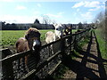
Ponies on Eltham Palace Fields
These ponies on Eltham Palace Fields were looking longingly at any passers-by who might have some food.
Image: © Marathon
Taken: 19 Mar 2021
0.14 miles