IMAGES TAKEN NEAR TO
Wicks Close, LONDON, SE9 4HE
Introduction
This page details the photographs taken nearby to Wicks Close, SE9 4HE by members of the Geograph project.
The Geograph project started in 2005 with the aim of publishing, organising and preserving representative images for every square kilometre of Great Britain, Ireland and the Isle of Man.

There are currently over 7.5m images from over14,400 individuals and you can help contribute to the project by visiting https://www.geograph.org.uk
Image Map
Images are licensed for reuse under creativecommons.org/licenses/by-sa/2.0
Notes
- Clicking on the map will re-center to the selected point.
- The higher the marker number, the further away the image location is from the centre of the postcode.
Image Listing (35 Images Found)
Images are licensed for reuse under creativecommons.org/licenses/by-sa/2.0
Image
Details
Distance
10
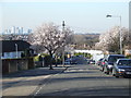
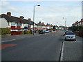
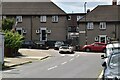
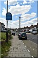
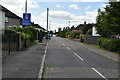
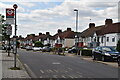
Springtime in Grove Park
Spring blossom on trees along Riddons Road, Grove Park. Behind the tree on the left side of the road is a telegraph pole with telephone wires stretching across the street to houses opposite. In the background, to the left, are the towers of Canary Wharf.
Image: © Malc McDonald
Taken: 19 Mar 2011
0.12 miles