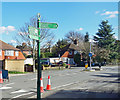
IMAGES TAKEN NEAR TO
West Hallowes, LONDON, SE9 4EX

Introduction

This page details the photographs taken nearby to West Hallowes, SE9 4EX by members of the Geograph project.

The Geograph project started in 2005 with the aim of publishing, organising and preserving representative images for every square kilometre of Great Britain, Ireland and the Isle of Man.

There are currently over 7.5m images from over14,400 individuals and you can help contribute to the project by visiting https://www.geograph.org.uk

Image Map


Images are licensed for reuse under creativecommons.org/licenses/by-sa/2.0
Notes
  • Clicking on the map will re-center to the selected point.
  • The higher the marker number, the further away the image location is from the centre of the postcode.

Image Listing (55 Images Found)

Images are licensed for reuse under creativecommons.org/licenses/by-sa/2.0
  • ...
Image
Details
Distance
1
Mottingham Gardens, Mottingham
Image: © Chris Whippet Taken: 21 Aug 2015
0.10 miles
2
Petrol Garage in Mottingham
A previous iteration of this garage was hit by a V2 bomb in WW2. Took the roofs off most of the houses in the local.
Image: © Martin Kerans Taken: 30 May 2009
0.11 miles
3
Railway towards Mottingham and Sidcup
The footbridge from which this photograph was taken is enveloped in steel mesh. It is only possible to use a small format camera at a fairly long focal length if severe cropping is to be avoided.
Image: © Robin Webster Taken: 4 Feb 2012
0.12 miles
4
Highcombe Close, Mottingham
Image: © Chris Whippet Taken: 21 Aug 2015
0.12 miles
5
Public footpath, Mottingham
A public footpath leading northwards from Mottingham Lane.
Image: © Malc McDonald Taken: 19 Mar 2011
0.13 miles
6
Small shuttered building
Probably to do with water - a stream issues nearby on maps, and before the building was built the stream issued about on this spot.
Image: © Robin Webster Taken: 4 Feb 2012
0.13 miles
7
Green Chain Signpost, Mottingham Lane
The Green Chain Walks are a series of routes linking parks and woodlands and other open spaces around south east London. Inevitably there is quite a bit of roadside walking, as along here, but major roads are avoided for the most part. The way markers are definitely among the best of any LDP signage, with these solid green guideposts all along the routes. https://tfl.gov.uk/modes/walking/green-chain-walk
Image: © Des Blenkinsopp Taken: 6 Mar 2020
0.13 miles
8
College View, Mottingham
Image: © Chris Whippet Taken: 21 Aug 2015
0.14 miles
9
The Little Quaggy north of Kippington Drive, SE9
This seems to be the furthest point east that the Little Quaggy is visible above ground. The stream is fed from the Image
Image: © Mike Quinn Taken: 23 Sep 2010
0.14 miles
10
Petrol station, Mottingham
A petrol station in Mottingham, in the suburbs of south east London.
Image: © Malc McDonald Taken: 18 Sep 2021
0.14 miles
  • ...