IMAGES TAKEN NEAR TO
Packmores Road, LONDON, SE9 2NA
Introduction
This page details the photographs taken nearby to Packmores Road, SE9 2NA by members of the Geograph project.
The Geograph project started in 2005 with the aim of publishing, organising and preserving representative images for every square kilometre of Great Britain, Ireland and the Isle of Man.

There are currently over 7.5m images from over14,400 individuals and you can help contribute to the project by visiting https://www.geograph.org.uk
Image Map
Images are licensed for reuse under creativecommons.org/licenses/by-sa/2.0
Notes
- Clicking on the map will re-center to the selected point.
- The higher the marker number, the further away the image location is from the centre of the postcode.
Image Listing (20 Images Found)
Images are licensed for reuse under creativecommons.org/licenses/by-sa/2.0
Image
Details
Distance
1
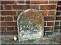
Borough of Woolwich boundary marker
Dated 1903, this marked the outer limit of the Metropolitan Borough of Woolwich, and so the boundary between the counties of London and Kent. With the creation of Greater London, this became the boundary between the London Boroughs of Greenwich and Bexley, Woolwich being absorbed into Greenwich. At this point the A210 changes name - Bexley Road in Greenwich, Blackfen Road in Bexley. South of the A210 here is a road named Parish Gate Drive, with the boundary initially running down its western side.
Image: © Robin Webster
Taken: 26 Feb 2012
0.08 miles
2
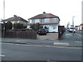
Houses on Blackfen Road
On the corner of Boundary Road, by the boundary with Greenwich.
Image: © David Howard
Taken: 23 Feb 2014
0.11 miles
4
The Jolly Fenman public house, Blackfen
Image: © Stacey Harris
Taken: 17 Jun 2009
0.18 miles
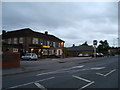
5
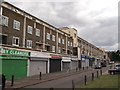
Shops on Bexley Road
Large block of flats, with a row of shops underneath.
Image: © David Anstiss
Taken: 15 Aug 2011
0.18 miles
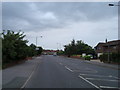
6
Houses on Chester Road from Blackfen Road
Image: © David Howard
Taken: 11 Mar 2012
0.19 miles
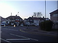
7
Junction of Bexley Road and Crown Woods Way
The BP garage was built in the last year or two before 2012
Image: © David Howard
Taken: 11 Mar 2012
0.19 miles
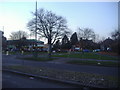
8
The junction of Bexley Road and Crown Woods Way
Image: © David Howard
Taken: 11 Mar 2012
0.20 miles
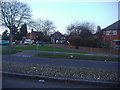
9
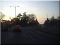
Junction of Blackfen Road and Avery Hill Road
Image: © David Howard
Taken: 11 Mar 2012
0.21 miles
10
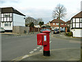
Corner pillar box
The appendage is a 'drop box' where the postman can store part of his round to save carrying all of it around. The stuck on message is about a lost cat.
Image: © Robin Webster
Taken: 26 Feb 2012
0.21 miles