IMAGES TAKEN NEAR TO
Eastnor Road, LONDON, SE9 2BG
Introduction
This page details the photographs taken nearby to Eastnor Road, SE9 2BG by members of the Geograph project.
The Geograph project started in 2005 with the aim of publishing, organising and preserving representative images for every square kilometre of Great Britain, Ireland and the Isle of Man.

There are currently over 7.5m images from over14,400 individuals and you can help contribute to the project by visiting https://www.geograph.org.uk
Image Map
Images are licensed for reuse under creativecommons.org/licenses/by-sa/2.0
Notes
- Clicking on the map will re-center to the selected point.
- The higher the marker number, the further away the image location is from the centre of the postcode.
Image Listing (88 Images Found)
Images are licensed for reuse under creativecommons.org/licenses/by-sa/2.0
Image
Details
Distance
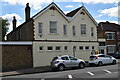
4
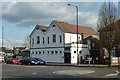
New Eltham Social Club
On Avery Hill Road, SE9.
Image: © Robin Webster
Taken: 26 Feb 2012
0.05 miles
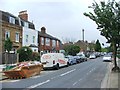
6
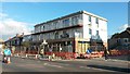
New flats and retail units nearing completion on Avery Hill Road
On the site of (yet another) former petrol station.
Image: © David Martin
Taken: 11 Oct 2016
0.06 miles
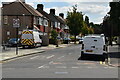
7
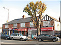
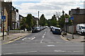
Avery Hill Road shops (1)
The parade on the south side of the road included (as of 2009) a newsagent, barber, hairdresser, fast food takeaway and signwriter.
Image: © Stephen Craven
Taken: 25 Oct 2009
0.06 miles
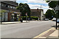
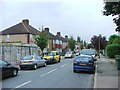
10
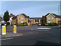
View across roundabout into Stanley Close
Image: © David Martin
Taken: 20 Sep 2012
0.07 miles