IMAGES TAKEN NEAR TO
Kinveachy Gardens, LONDON, SE7 8EH
Introduction
This page details the photographs taken nearby to Kinveachy Gardens, SE7 8EH by members of the Geograph project.
The Geograph project started in 2005 with the aim of publishing, organising and preserving representative images for every square kilometre of Great Britain, Ireland and the Isle of Man.

There are currently over 7.5m images from over14,400 individuals and you can help contribute to the project by visiting https://www.geograph.org.uk
Image Map
Images are licensed for reuse under creativecommons.org/licenses/by-sa/2.0
Notes
- Clicking on the map will re-center to the selected point.
- The higher the marker number, the further away the image location is from the centre of the postcode.
Image Listing (106 Images Found)
Images are licensed for reuse under creativecommons.org/licenses/by-sa/2.0
Image
Details
Distance
1
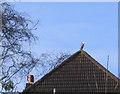
Urban Heron
Herons are often seen by the Thames, this one found a perch half a mile from the river on a neighbour's rooftop.
Image: © Stephen Craven
Taken: 25 Mar 2006
0.03 miles
2
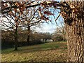
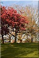
Maryon Wilson Park, Charlton
The land now taken up by Maryon Wilson Park was once part of the Hanging Wood which originally stretched from Woolwich Common to Charlton and which provided shelter for the highwaymen of Shooters Hill and Blackheath. Samuel Pepys often told of his dread of Hanging Wood when he was obliged to travel to Woolwich. Although still partly wooded it is rather more peaceful nowadays. The path ahead is followed by the Green Chain Walk and Capital Ring.
Image: © Marathon
Taken: 29 Sep 2012
0.08 miles
3
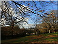
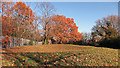
View from Maryon Wilson Park
The land now taken up by Maryon Wilson Park was once part of the Hanging Wood which originally stretched from Woolwich Common to Charlton and which provided shelter for the highwaymen of Shooters Hill and Blackheath. Samuel Pepys often told of his dread of Hanging Wood when he was obliged to travel to Woolwich.
Although still woodland it is rather more peaceful nowadays. The path followed by the Green Chain Walk and Capital Ring climbs steadily from the Thames through Maryon Park and then Maryon Wilson Park to reach the exit opposite Cemetery Lane. This view looks down the hill from near the animal park.
Image: © Marathon
Taken: 20 Dec 2020
0.08 miles
4
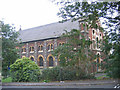
St Thomas Church
Anglican parish church, built 1850 to the designs of Joseph Gwilt. Listed Grade C.
Image: © Stephen Craven
Taken: 17 Oct 2006
0.09 miles
5
In Maryon Wilson Park
The land now taken up by Maryon Wilson Park was once part of the Hanging Wood which originally stretched from Woolwich Common to Charlton and which provided shelter for the highwaymen of Shooters Hill and Blackheath. Samuel Pepys often told of his dread of Hanging Wood when he was obliged to travel to Woolwich.
Although still woodland it is rather more peaceful nowadays. The path followed by the Green Chain Walk and Capital Ring climbs steadily from the Thames through Maryon Park and then Maryon Wilson Park to reach the exit opposite Cemetery Lane. This view looks down the hill from near the animal park towards Canary Wharf.
Image: © Marathon
Taken: 20 Dec 2020
0.09 miles
6
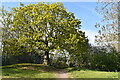
The Capital Ring (005)
This is a look back to a tree at the top of the hill in Maryon Park.
Image: © Shazz
Taken: 29 Mar 2019
0.09 miles
7
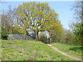
Tree beside the Capital Ring walking route
Image: © David Martin
Taken: 24 Apr 2021
0.09 miles
8
Evening light on open space beside Thorntree Road
Image: © David Martin
Taken: 24 Apr 2021
0.09 miles
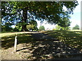
10
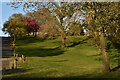
On the edge of Maryon Park
Undulations due to gravel digging.
Image: © Dylan Moore
Taken: 29 Nov 2019
0.09 miles