IMAGES TAKEN NEAR TO
Woolwich Road, LONDON, SE7 7RB
Introduction
This page details the photographs taken nearby to Woolwich Road, SE7 7RB by members of the Geograph project.
The Geograph project started in 2005 with the aim of publishing, organising and preserving representative images for every square kilometre of Great Britain, Ireland and the Isle of Man.

There are currently over 7.5m images from over14,400 individuals and you can help contribute to the project by visiting https://www.geograph.org.uk
Image Map
Images are licensed for reuse under creativecommons.org/licenses/by-sa/2.0
Notes
- Clicking on the map will re-center to the selected point.
- The higher the marker number, the further away the image location is from the centre of the postcode.
Image Listing (147 Images Found)
Images are licensed for reuse under creativecommons.org/licenses/by-sa/2.0
Image
Details
Distance
2
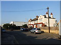
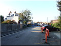
Royal Greenwich Dry Cleaners on Woolwich Road
Image: © Steve Daniels
Taken: 1 Oct 2022
0.02 miles
4
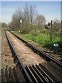
Angerstein Wharf branch railway line
The Angerstein Wharf branch railway line is one of the very few freight railway lines left in the Greater London area which serve the River Thames and are still active. It branches away from the North Kent Line near Charlton station and heads north to terminate at Angerstein's Wharf on the Thames, one mile away.
John Angerstein was a successful businessman from a Russian family and is thought to be the only individual to obtain an Act of Parliament for a railway. If the branch had not passed over a turnpike road he would not have needed to go to this trouble. Today long lines of hopper wagons can be seen passing over Woolwich Road and Bugsby's Way on their way to and from the Thames.
For the scene at the other end of the line see http://www.geograph.org.uk/photo/2372236
For more information, an update and photographs see https://www.ianvisits.co.uk/blog/2021/05/31/londons-alleys-fairthorne-road-se7/?utm_source=newsletter&utm_medium=email&utm_campaign=weeklyemailblog
Image: © Marathon
Taken: 7 Apr 2011
0.03 miles
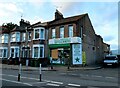
6
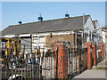
Neptune House
This building and surrounding yard at the end of Holmwood Villas is apparnetly home to Balmoral Waste Management. There was a Hazchem sign, code 2R (acid) on the gate.
Image: © Stephen Craven
Taken: 18 Apr 2010
0.04 miles
7
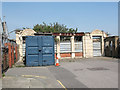
Old factory entrance, Holmwood Villas
Holmwood Villas is the name of a short street off Woolwich Road ending in this dead end. The quality of the stonework of these arches suggests they were the main entrance to a factory or other building (I have not yet found out what). See also Image on the far side of the currently derelict site.
Image: © Stephen Craven
Taken: 18 Apr 2010
0.05 miles
8
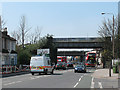
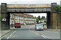
Railway bridge over Woolwich Road
The bridge carries a single track freight railway. See Image which shows a train about to pass over the bridge.
The road sign in front of the bridge is for the roundabout beyond it, which gives access to the A102 (Blackwall Tunnel approach road).
Image: © Stephen Craven
Taken: 18 Apr 2010
0.05 miles
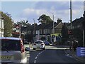
10
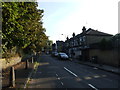
Farmdale Road, Greenwich
Before the construction of the A102 in the 1960s this was part of Westcombe Hill.
Image: © Chris Whippet
Taken: 22 Sep 2014
0.06 miles