IMAGES TAKEN NEAR TO
Gairloch Road, LONDON, SE5 8NG
Introduction
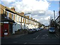
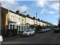
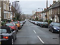
This page details the photographs taken nearby to Gairloch Road, SE5 8NG by members of the Geograph project.
The Geograph project started in 2005 with the aim of publishing, organising and preserving representative images for every square kilometre of Great Britain, Ireland and the Isle of Man.

There are currently over 7.5m images from over14,400 individuals and you can help contribute to the project by visiting https://www.geograph.org.uk
Image Map
Images are licensed for reuse under creativecommons.org/licenses/by-sa/2.0
Notes
- Clicking on the map will re-center to the selected point.
- The higher the marker number, the further away the image location is from the centre of the postcode.
Image Listing (77 Images Found)
Images are licensed for reuse under creativecommons.org/licenses/by-sa/2.0
Image
Details
Distance
7
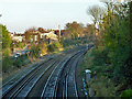
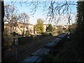
Railway east of Grove Tunnel
The Catford Loop line on the left, the South London line on the right.
Image: © Robin Webster
Taken: 19 Nov 2011
0.09 miles
10
Railway line and freight train
As seen from Camberwell Grove.
This freight train heading under the bridge is on the railway line from Peckham to Brixton.
Image: © David Anstiss
Taken: 26 Nov 2010
0.15 miles