IMAGES TAKEN NEAR TO
Vestry Road, LONDON, SE5 8JW
Introduction
This page details the photographs taken nearby to Vestry Road, SE5 8JW by members of the Geograph project.
The Geograph project started in 2005 with the aim of publishing, organising and preserving representative images for every square kilometre of Great Britain, Ireland and the Isle of Man.

There are currently over 7.5m images from over14,400 individuals and you can help contribute to the project by visiting https://www.geograph.org.uk
Image Map
Images are licensed for reuse under creativecommons.org/licenses/by-sa/2.0
Notes
- Clicking on the map will re-center to the selected point.
- The higher the marker number, the further away the image location is from the centre of the postcode.
Image Listing (181 Images Found)
Images are licensed for reuse under creativecommons.org/licenses/by-sa/2.0
Image
Details
Distance
6
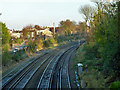
Railway east of Grove Tunnel
The Catford Loop line on the left, the South London line on the right.
Image: © Robin Webster
Taken: 19 Nov 2011
0.10 miles
7
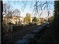
Railway line and freight train
As seen from Camberwell Grove.
This freight train heading under the bridge is on the railway line from Peckham to Brixton.
Image: © David Anstiss
Taken: 26 Nov 2010
0.10 miles
8
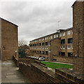
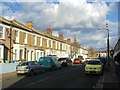
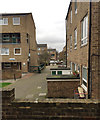
Edgecombe House, Lettsom Estate, Camberwell, south London
The familiar form of maisonettes though in a bland brick. A map of 1974-76 shows white space where the estate is, so construction probably began around then.
Image: © Robin Stott
Taken: 21 Feb 2017
0.10 miles
9
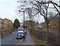
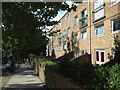
Footpath through the Lettsom Estate, Camberwell, south London
The estate was probably built in the late 1970s. The nearest block on the left is Edgecombe House, then Fowler House, then Rignold House. The blocks on the right have frontages to McNeil Road.
Image: © Robin Stott
Taken: 21 Feb 2017
0.11 miles
10
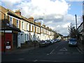
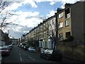
Terraced flats south of Lettsom Street, Camberwell Grove
Going south on Camberwell Grove there is more late 19th-century and 20th-century housing than at the older, north end: see Stephen Richards' photos of Georgian housing in Image
Image: © Robin Stott
Taken: 4 Aug 2013
0.13 miles