IMAGES TAKEN NEAR TO
Dragonfly Place, LONDON, SE4 2FL
Introduction
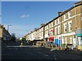
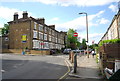
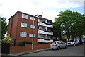
This page details the photographs taken nearby to Dragonfly Place, SE4 2FL by members of the Geograph project.
The Geograph project started in 2005 with the aim of publishing, organising and preserving representative images for every square kilometre of Great Britain, Ireland and the Isle of Man.

There are currently over 7.5m images from over14,400 individuals and you can help contribute to the project by visiting https://www.geograph.org.uk
Image Map
Images are licensed for reuse under creativecommons.org/licenses/by-sa/2.0
Notes
- Clicking on the map will re-center to the selected point.
- The higher the marker number, the further away the image location is from the centre of the postcode.
Image Listing (118 Images Found)
Images are licensed for reuse under creativecommons.org/licenses/by-sa/2.0
Image
Details
Distance
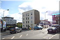
9
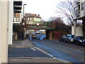
Railway bridge over Mantle Road, Brockley
Image: © Ruth Sharville
Taken: 2 Jan 2023
0.09 miles
10
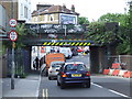
Mantle Road, Brockley
Mantle Road in Brockley. Here the road passes beneath a low railway bridge. Vehicles more than 8 feet 6 inches (or 2.6 metres) high are prohibited from passing under the bridge - although the marks on the warning markings suggest that plenty have tried.
Image: © Malc McDonald
Taken: 29 Jun 2011
0.09 miles