IMAGES TAKEN NEAR TO
Wricklemarsh Road, LONDON, SE3 8DR
Introduction
This page details the photographs taken nearby to Wricklemarsh Road, SE3 8DR by members of the Geograph project.
The Geograph project started in 2005 with the aim of publishing, organising and preserving representative images for every square kilometre of Great Britain, Ireland and the Isle of Man.

There are currently over 7.5m images from over14,400 individuals and you can help contribute to the project by visiting https://www.geograph.org.uk
Image Map
Images are licensed for reuse under creativecommons.org/licenses/by-sa/2.0
Notes
- Clicking on the map will re-center to the selected point.
- The higher the marker number, the further away the image location is from the centre of the postcode.
Image Listing (48 Images Found)
Images are licensed for reuse under creativecommons.org/licenses/by-sa/2.0
Image
Details
Distance
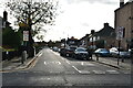
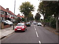
1
Holburne Road, Kidbrooke
At the heart of a large low-rise housing estate.
Image: © Stephen Craven
Taken: 27 Feb 2015
0.10 miles
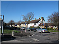
2
Kidbrooke Park Primary School
Just one of several buildings making up this school site, seen from Hargood Road.
Image: © Stephen Craven
Taken: 27 Feb 2015
0.13 miles
3
Former bowling green off Begbie Road
See also Image
Image: © Stephen Craven
Taken: 27 Feb 2015
0.13 miles
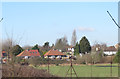
4
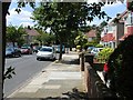
Harraden Road SE3
Part of a development of semi-detached houses that was built on farmland in the 1930s
Image: © David Hatch
Taken: 18 Jun 2005
0.16 miles
6
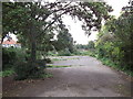
Disused Bowling Centre
This patch of land on the corner of Hervey Road (from where the photo was taken) and Begbie Road, was a Bowling Ground.
Now a prime piece of development land.
Image: © David Anstiss
Taken: 11 Sep 2011
0.18 miles
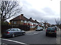
7
Begbie Road, Kidbrooke
This road leads from Harvey Road towards Wricklemarsh Road.
Image: © David Anstiss
Taken: 11 Sep 2011
0.19 miles
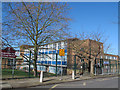
8
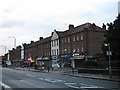
Shooters Hill shops
A shopping parade on the south side of this historic road (the old Roman route south-east from London). Units as of the end of 2012 included a cafe, launderette, betting shop, pharmacy, two convenience stores, newsagent, and at the far end the Co-Operative store. This being Christmas Day, all but two of the shops were closed. There is also a bus shelter.
Image: © Stephen Craven
Taken: 25 Dec 2012
0.20 miles
9
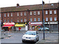
Christmas convenience
The two convenience stores in the shopping parade on Shooters Hill Image were even open on Christmas Day, although the sub post office in one of them was presumably closed.
Image: © Stephen Craven
Taken: 25 Dec 2012
0.20 miles