IMAGES TAKEN NEAR TO
Summerton Way, LONDON, SE28 8QY
Introduction
This page details the photographs taken nearby to Summerton Way, SE28 8QY by members of the Geograph project.
The Geograph project started in 2005 with the aim of publishing, organising and preserving representative images for every square kilometre of Great Britain, Ireland and the Isle of Man.

There are currently over 7.5m images from over14,400 individuals and you can help contribute to the project by visiting https://www.geograph.org.uk
Image Map
Images are licensed for reuse under creativecommons.org/licenses/by-sa/2.0
Notes
- Clicking on the map will re-center to the selected point.
- The higher the marker number, the further away the image location is from the centre of the postcode.
Image Listing (43 Images Found)
Images are licensed for reuse under creativecommons.org/licenses/by-sa/2.0
Image
Details
Distance
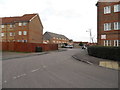
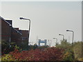
1
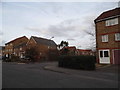
Summerton Way looking towards Turnbury Close
Image: © David Howard
Taken: 23 Feb 2014
0.01 miles
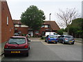
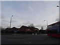
2
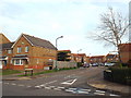
Turnbury Close, Thamesmead
Turnbury Road is a residential cul-de-sac in Thamesmead, in south east London.
Image: © Malc McDonald
Taken: 30 Dec 2017
0.01 miles
3
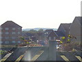
View of the hills above the houses in Lytham Close
Looking south-southwest from the Thames Path.
Image: © Robert Lamb
Taken: 23 Oct 2011
0.08 miles
4
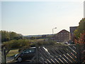
View of the hills above the houses in Lytham Close #2
Looking south-southwest.
Image: © Robert Lamb
Taken: 23 Oct 2011
0.10 miles
5
Redbourne Drive at the junction of Fairway Drive
Image: © David Howard
Taken: 23 Feb 2014
0.11 miles
7
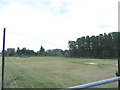
golf driving range
The golf driving range, situated at the end of Fairway Drive (where else?) in Thamesmead
Image: © Stephen Craven
Taken: 8 Jul 2006
0.13 miles
8
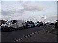
St Andrews Close, Thamesmead
Cross Ness, the point on the right where the edge of the road meets the river, is the furthest north point south of the river to the east of London. There is only a small strip of land here which is actually north of the Embankment at Charing Cross. It used to be marshes until the new area of Thamesmead was begun in the 70s, creating a brand new postcode of SE28, dividing SE2 in two.
Image: © David Howard
Taken: 23 Feb 2014
0.16 miles
9
View of the Barking Creek Flood Barrier from the Thames Path
Looking west-northwest across St Andrew's Close.
Image: © Robert Lamb
Taken: 23 Oct 2011
0.16 miles
10
Roundabout on Crossway, Thamesmead
At the junction with Summerton Way
Image: © David Howard
Taken: 23 Feb 2014
0.16 miles