IMAGES TAKEN NEAR TO
Hamilton Road, LONDON, SE27 9SF
Introduction
This page details the photographs taken nearby to Hamilton Road, SE27 9SF by members of the Geograph project.
The Geograph project started in 2005 with the aim of publishing, organising and preserving representative images for every square kilometre of Great Britain, Ireland and the Isle of Man.

There are currently over 7.5m images from over14,400 individuals and you can help contribute to the project by visiting https://www.geograph.org.uk
Image Map
Images are licensed for reuse under creativecommons.org/licenses/by-sa/2.0
Notes
- Clicking on the map will re-center to the selected point.
- The higher the marker number, the further away the image location is from the centre of the postcode.
Image Listing (76 Images Found)
Images are licensed for reuse under creativecommons.org/licenses/by-sa/2.0
Image
Details
Distance
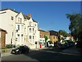
2
Semi-detached houses, South Croxted Road, West Dulwich
Image: © Robin Stott
Taken: 17 May 2022
0.06 miles
3
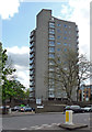
Northwood House, Hamilton Road
This is run by Lambeth Council as a sheltered housing scheme. Built by Lambeth, c1966.
Image: © Stephen Richards
Taken: 12 May 2012
0.07 miles
4
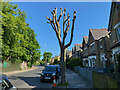
Pollarded street tree, South Croxted Road, Gipsy Hill, London
The Crystal Palace transmitter can be seen to the left.
Image: © Robin Stott
Taken: 14 May 2022
0.08 miles
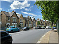
5

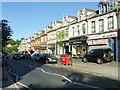
Shops, Gipsy Road, West Norwood
The pyramidal roof at the end belongs to The Paxton public house Image
Image: © Robin Stott
Taken: 6 Mar 2020
0.08 miles
6
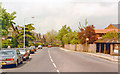
NW on South Croxted Road, West Dulwich 1983
View towards Herne Hill and London on A2199 at Alleyn Road (off to the right). Over thirty years later, perhaps a 'Period' scene?
Image: © Ben Brooksbank
Taken: 21 May 1983
0.08 miles
8
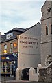
"Ghost sign", Gipsy Hill
https://en.wikipedia.org/wiki/South_Suburban_Co-operative_Society.
Image: © Jim Osley
Taken: 31 Oct 2015
0.08 miles
9
Gipsy Road
Shops along the stretch of road between the Two Towers and the Paxton. I hope that rubbish gets collected today.
Image: © Derek Harper
Taken: 9 May 2013
0.08 miles
10
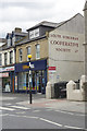
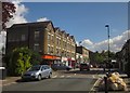
Gipsy Road, West Norwood
The premises straight ahead are now occupied by a bookmaker's but were evidently once part of the South Suburban Cooperative Society Ltd.
Image: © Stephen McKay
Taken: 6 Sep 2018
0.09 miles