IMAGES TAKEN NEAR TO
Bailey Place, LONDON, SE26 5NY
Introduction
This page details the photographs taken nearby to Bailey Place, SE26 5NY by members of the Geograph project.
The Geograph project started in 2005 with the aim of publishing, organising and preserving representative images for every square kilometre of Great Britain, Ireland and the Isle of Man.

There are currently over 7.5m images from over14,400 individuals and you can help contribute to the project by visiting https://www.geograph.org.uk
Image Map
Images are licensed for reuse under creativecommons.org/licenses/by-sa/2.0
Notes
- Clicking on the map will re-center to the selected point.
- The higher the marker number, the further away the image location is from the centre of the postcode.
Image Listing (155 Images Found)
Images are licensed for reuse under creativecommons.org/licenses/by-sa/2.0
Image
Details
Distance
1
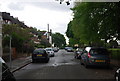
Maitland Rd
Route of the Green Chain walk and Capital Ring.
Image: © N Chadwick
Taken: 9 May 2010
0.03 miles
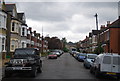
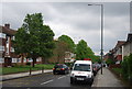
4
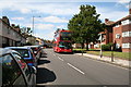
Penge: Lennard Road
Looking northwest. The bus is on Route 194 which operates between West Croydon and Sydenham by a roundabout route via Shirley.
Image: © Dr Neil Clifton
Taken: 31 Aug 2012
0.05 miles
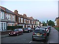
7
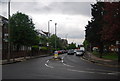
A213, Penge
Note the Green Chain Walk and Capital Ring signs to the left.
Image: © N Chadwick
Taken: 9 May 2010
0.06 miles
8
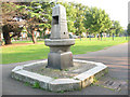
Metropolitan Drinking Fountain, Penge
The fountain is one of those supplied by the Metropolitan Drinking Fountain and Cattle Trough Association. There is a forum discussion on these at http://www.geograph.org.uk/discuss/index.php?&action=vthread&forum=6&topic=7583 . The inscription giving its original date and location is indistinct, but it was re-erected here in Image in September 1891 at the opening of the park.
Image: © Stephen Craven
Taken: 30 Aug 2008
0.06 miles
9
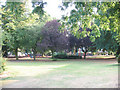
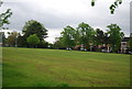
Alexandra Road Recreation Ground (1)
The southern end of this park - one of several in the Penge/Beckenham area - is the more intimate, with plenty of trees and paths and a children's playground. For a bit more history see Image
Image: © Stephen Craven
Taken: 30 Aug 2008
0.07 miles
10
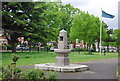
Metropolitan Drinking Fountain, Alexandra Recreation Ground
Erected here in 1891 to celebrate the opening of Alexandra Recreation Ground.
Image: © N Chadwick
Taken: 9 May 2010
0.07 miles