IMAGES TAKEN NEAR TO
Montgomerie Mews, LONDON, SE23 3QP
Introduction
This page details the photographs taken nearby to Montgomerie Mews, SE23 3QP by members of the Geograph project.
The Geograph project started in 2005 with the aim of publishing, organising and preserving representative images for every square kilometre of Great Britain, Ireland and the Isle of Man.

There are currently over 7.5m images from over14,400 individuals and you can help contribute to the project by visiting https://www.geograph.org.uk
Image Map
Images are licensed for reuse under creativecommons.org/licenses/by-sa/2.0
Notes
- Clicking on the map will re-center to the selected point.
- The higher the marker number, the further away the image location is from the centre of the postcode.
Image Listing (146 Images Found)
Images are licensed for reuse under creativecommons.org/licenses/by-sa/2.0
Image
Details
Distance
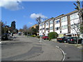
1
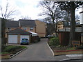
Montgomery Mews
Built in 2004, small development on the upper end of Dunoon Road.
Image: © Brian Whittle
Taken: 21 Mar 2008
0.01 miles
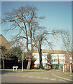
2
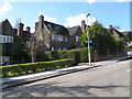
Dunoon Road detached houses
Inter-war detached houses built on the steep section of Dunoon Road.
Image: © Brian Whittle
Taken: 21 Mar 2008
0.03 miles
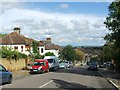
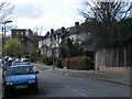
4
Dunoon Road, SE23
Dunoon Road, photographed from Honor Oak Road.
Image: © Malc McDonald
Taken: 27 Jun 2010
0.05 miles
5
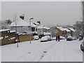
Freedom from the car
Heavy snow in Dunoon Road frees the local residents to chat in the road
Image: © Brian Whittle
Taken: 2 Feb 2009
0.05 miles
6
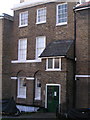
Converted Georgian SE23
On Honor Oak Rd, the early C19th section of what is now a block of flats, was probably converted around the First World War.
Image: © Brian Whittle
Taken: 10 Apr 2008
0.06 miles
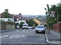
7
Fairlie Gardens, SE23
Cul-de-sac off Dunoon Road
Image: © Brian Whittle
Taken: 21 Mar 2008
0.07 miles
8
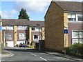
Bowman's Lea, SE23
Small mid-1970's development off the upper end of Dunoon Road.
Image: © Brian Whittle
Taken: 21 Mar 2008
0.07 miles
9
Early 1970's townhouses in Dunoon Road
The sharp turn in the road makes the position of the old Croydon Canal.
Image: © Brian Whittle
Taken: 21 Mar 2008
0.07 miles
10
Haredon Close
Photo taken in January 1987. These town houses were constructed on the site of a former Guy's Hospital staff leisure facility.
Image: © David Wright
Taken: Unknown
0.07 miles