IMAGES TAKEN NEAR TO
Dacres Estate, Dacres Road, LONDON, SE23 2BW

Introduction

This page details the photographs taken nearby to Dacres Estate, Dacres Road, SE23 2BW by members of the Geograph project.

The Geograph project started in 2005 with the aim of publishing, organising and preserving representative images for every square kilometre of Great Britain, Ireland and the Isle of Man.

There are currently over 7.5m images from over14,400 individuals and you can help contribute to the project by visiting https://www.geograph.org.uk

Image Map


Images are licensed for reuse under creativecommons.org/licenses/by-sa/2.0
Notes
  • Clicking on the map will re-center to the selected point.
  • The higher the marker number, the further away the image location is from the centre of the postcode.

Image Listing (52 Images Found)

Images are licensed for reuse under creativecommons.org/licenses/by-sa/2.0
  • ...
Image
Details
Distance
1
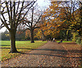
Mayow Park
Trees form a graceful avenue around the northern edge of the park, which takes its name from the family of Mayow Wynell Mayow, a lawyer who acquired a large estate here in 1786. See also http://www.geograph.org.uk/search.php?i=41466593 .
Image: © Derek Harper Taken: 9 May 2013
0.05 miles
2
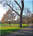
Mayow Park (4)
The vivid colours have actually been toned down - the product of a very mild and sunny November day.
Image: © Stephen Richards Taken: 30 Nov 2014
0.05 miles
3
Mayow Park (5)
The leaves of a large oak at the north-west corner of the park on a very sunny and mild November day.
Image: © Stephen Richards Taken: 30 Nov 2014
0.06 miles
4
Mayow Park
As seen from close to the entrance from Silverdale.
Image: © David Anstiss Taken: 2 Oct 2011
0.06 miles
5
Mayow Park (6)
On a very mild and sunny November day.
Image: © Stephen Richards Taken: 30 Nov 2014
0.07 miles
6
Mayow Park
Image: © N Chadwick Taken: 12 May 2012
0.08 miles
7
Mayow Park (3)
The vivid colours have actually been toned down - the product of a very mild and sunny November day.
Image: © Stephen Richards Taken: 30 Nov 2014
0.08 miles
8
Mayow Park
A jogger enters the park http://www.lewisham.gov.uk/inmyarea/openspaces/parks/Pages/mayow-park.aspx from the Silverdale entrance. See also http://www.geograph.org.uk/search.php?i=41466593 for other images.
Image: © Derek Harper Taken: 9 May 2013
0.09 miles
9
Mayow Park
Mayow Park, originally Sydenham Recreation Ground, is Lewisham borough's oldest municipal park, opened in 1878. The Rev W Taylor Jones (a local headmaster) acquired the land for the park.
Image: © Stephen Craven Taken: 8 Jun 2008
0.10 miles
10
Dacres Road, Lewisham
Image: © Ian S Taken: 9 Dec 2010
0.10 miles
  • ...