IMAGES TAKEN NEAR TO
Dovercourt Road, LONDON, SE22 8SS
Introduction
This page details the photographs taken nearby to Dovercourt Road, SE22 8SS by members of the Geograph project.
The Geograph project started in 2005 with the aim of publishing, organising and preserving representative images for every square kilometre of Great Britain, Ireland and the Isle of Man.

There are currently over 7.5m images from over14,400 individuals and you can help contribute to the project by visiting https://www.geograph.org.uk
Image Map
Images are licensed for reuse under creativecommons.org/licenses/by-sa/2.0
Notes
- Clicking on the map will re-center to the selected point.
- The higher the marker number, the further away the image location is from the centre of the postcode.
Image Listing (66 Images Found)
Images are licensed for reuse under creativecommons.org/licenses/by-sa/2.0
Image
Details
Distance
1
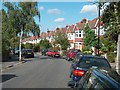
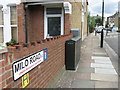
Dovercourt Road, Dulwich.
Typical suburban street of nearly identical semi-detached houses.
Image: © Noel Foster
Taken: 27 Sep 2005
0.05 miles
2
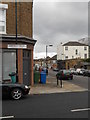
The junction of Landcroft Road and Pellatt Road
Image: © Andrew Wilson
Taken: 4 May 2013
0.09 miles
4
Pre-fab in Lordship Lane
A sight that is becoming increasingly rare. A shame that the cars spoil the remarkable front garden display.
Image: © Brian Whittle
Taken: 6 Nov 2017
0.10 miles
7
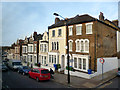
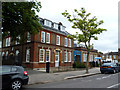
Corner of Heber Road, Dulwich
The corner of Heber Road and Lordship Lane.
Most of the old painted sign on the side of this end terrace is too far gone to read, but "surgery" at the bottom is still legible.
Image: © Des Blenkinsopp
Taken: 28 Feb 2013
0.12 miles
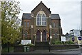
8
Dulwich: Lordship Lane Baptist Church
Image: © Dr Neil Clifton
Taken: 18 Jul 2012
0.13 miles
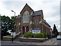
9
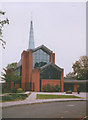
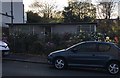
St Barnabas Church Dulwich
An Anglican church built around 2000 to replace the original church which was destroyed in a fire.
Image: © Linda Craven
Taken: Unknown
0.13 miles
10
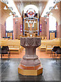
St Barnabas, Calton Avenue, Dulwich, London SE21 - Font
Image: © John Salmon
Taken: 27 Nov 2004
0.13 miles