IMAGES TAKEN NEAR TO
Thurlow Hill, LONDON, SE21 8JW
Introduction
This page details the photographs taken nearby to Thurlow Hill, SE21 8JW by members of the Geograph project.
The Geograph project started in 2005 with the aim of publishing, organising and preserving representative images for every square kilometre of Great Britain, Ireland and the Isle of Man.

There are currently over 7.5m images from over14,400 individuals and you can help contribute to the project by visiting https://www.geograph.org.uk
Image Map
Images are licensed for reuse under creativecommons.org/licenses/by-sa/2.0
Notes
- Clicking on the map will re-center to the selected point.
- The higher the marker number, the further away the image location is from the centre of the postcode.
Image Listing (193 Images Found)
Images are licensed for reuse under creativecommons.org/licenses/by-sa/2.0
Image
Details
Distance
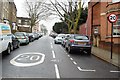
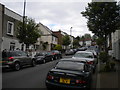
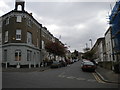
3
Houses in SE21
Birkbeck Place and Thurlow Hill at their junction with Lovelace Road. The junction is on the margins of Tulse Hill and West Dulwich.
Image: © Derek Harper
Taken: 11 Mar 2011
0.04 miles
4
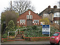
Church hall for sale
This church hall on Lovelace Road was up for sale or lease as of 2011. It had most recently been used by the Dulwich Church of God according to the notice board.
Image: © Stephen Craven
Taken: 24 Feb 2011
0.04 miles
5
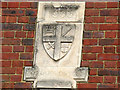
Date stone on Lovelace Road church hall
This date stone reads 1933, with an inscription in Greek condensed from the Epistle to the Hebrews 12:2 ἀφορῶντες εἰς Ἰησοῦν "Looking unto Jesus".
For the building in context, see Image
Image: © Stephen Craven
Taken: 24 Feb 2011
0.04 miles
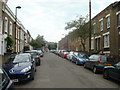
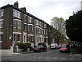
6
Upper half of Birkbeck Hill, Tulse Hill
Image: © Richard Vince
Taken: 14 May 2016
0.05 miles
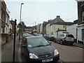
7
Bottom half of Thurlow Hill, Tulse Hill
Image: © Richard Vince
Taken: 14 May 2016
0.05 miles
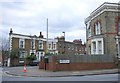
8
Birkbeck Place, Tulse Hill
Seen from Birkbeck Hill.
Image: © Richard Vince
Taken: 14 May 2016
0.06 miles
9
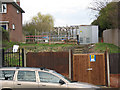
Substation on Lovelace Road
The electricity substation is in a gap between houses on the north-west side of the road, which also gives access to the allotments behind.
Image: © Stephen Craven
Taken: 24 Feb 2011
0.07 miles