IMAGES TAKEN NEAR TO
Thurlow Park Road, LONDON, SE21 8JL
Introduction
This page details the photographs taken nearby to Thurlow Park Road, SE21 8JL by members of the Geograph project.
The Geograph project started in 2005 with the aim of publishing, organising and preserving representative images for every square kilometre of Great Britain, Ireland and the Isle of Man.

There are currently over 7.5m images from over14,400 individuals and you can help contribute to the project by visiting https://www.geograph.org.uk
Image Map
Images are licensed for reuse under creativecommons.org/licenses/by-sa/2.0
Notes
- Clicking on the map will re-center to the selected point.
- The higher the marker number, the further away the image location is from the centre of the postcode.
Image Listing (141 Images Found)
Images are licensed for reuse under creativecommons.org/licenses/by-sa/2.0
Image
Details
Distance
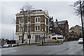
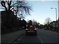
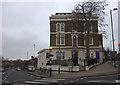
2
South Circular Road, near Lancaster Avenue.
Image: © Robert Eva
Taken: 16 Jan 2019
0.04 miles
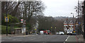
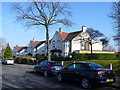
5
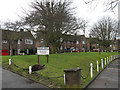
Private green on Lovelace Road
This row of houses has a private drive and a small green.
Image: © Stephen Craven
Taken: 24 Feb 2011
0.05 miles
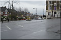
8
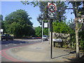
Thurlow Park Road at the junction of Dalmore Road
Image: © David Howard
Taken: 27 May 2012
0.05 miles
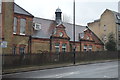
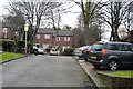
10
Houses in Lovelace Rd
These grand semi detached houses are on the southern edge of the grid square.
Image: © Nigel Mykura
Taken: 5 Mar 2013
0.05 miles